
SERVIR team members come together for week-long Information Technology exchange
Team members of the NASA/USAID SERVIR program converged in Huntsville, Alabama, for a special workshop 18-22 April 2016. NASA Marshall Space Flight Center's SERVIR Science Coordination Office (SCO) hosted an Information Technology exchange for members of the SERVIR global network involved with Geospatial Information Technology (GIT).
Attendees traveled to the event from SERVIR-Himalaya at the International Centre for Integrated Mountain Development (ICIMOD) based in Kathmandu, Nepal; SERVIR-Eastern & Southern Africa at the Regional Center for Mapping of Resources for Development (RCMRD) in Nairobi, Kenya; SERVIR-Mekong at the Asian Disaster Preparedness Center (ADPC) in Bangkok, Thailand; and Spatial Informatics Group (SIG) in San Francisco, California.
“It is important that we meet other people from different hubs face to face,” said Kittiphong “Ake” Phongsapan, Senior GIS Coordinator at SERVIR-Mekong. “It’s a lot better than communicating through e-mails, phone calls, and Skype. This event made me feel more comfortable to contact the other people. Now they are people that I know, and I also know he or she is really willing to help.”
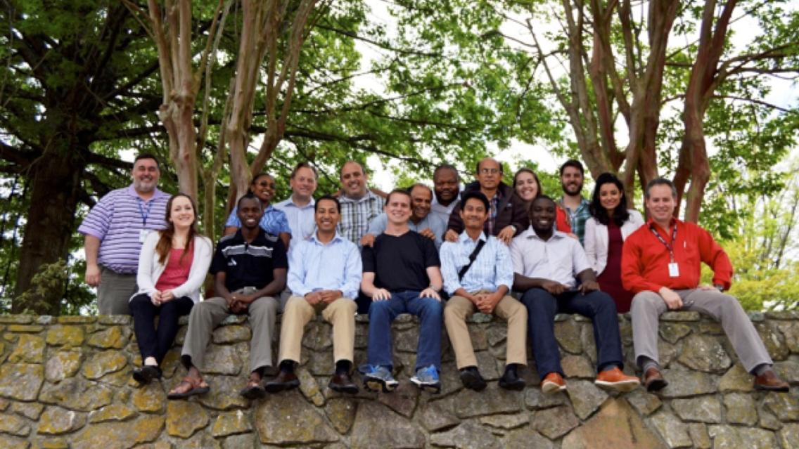
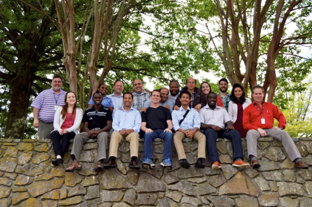 |
| GIT Workshop attendees take time out on Earth Day (April 22nd) for a group photo |
Mir Matin, Science and Data Lead from SERVIR-Himalaya, called the event “highly successful” and said “the most important accomplishment was that we collectively worked on developing an action plan and strategy for GIT for SERVIR.”
Some of the workshop sessions provided opportunities for sharing capabilities and lessons learned on topics such as application and data development plans, technological platform management, use of open source and commercial software, and key GIT projects.
“It was interesting to find that some of the challenges we have are also in the other hubs,” noted SERVIR-Eastern and Southern Africa Science and Data Lead Anastasia Wahome. “We were able to share and try to find solutions together, for example harvesting metadata from GeoNetwork into GeoNode. All three SERVIR hubs are using GeoNetwork for metadata, so it was a great discussion to look at the benefits and the common challenges.”
Phongsapan added: “I learned how the other hubs are dealing with their own metadata and related platforms. The SERVIR-Mekong hub might replicate the platform other hubs use for the data catalog and adapt it for use with our own data.”
Also included in the workshop agenda were sessions in which representatives from Esri, Google, and Digital Globe briefed the participants about experimental technologies and new products available to the GIT community. In addition, the United Nations Food and Agriculture Organization (FAO) joined remotely to brief the team about Collect Earth, an open source platform that enables data collection from high-resolution satellite imagery.
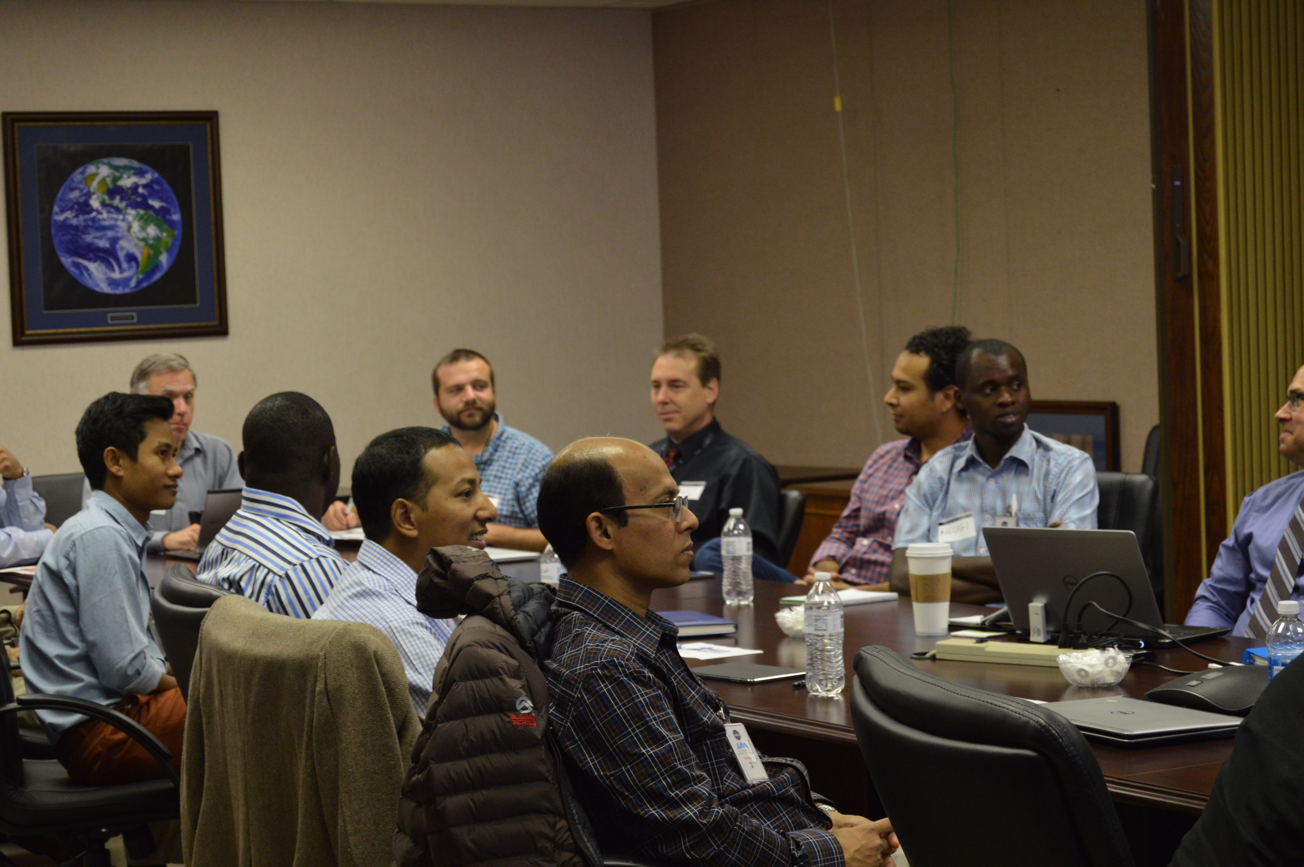 |
| Workshop attendees gather to hear about innovations in IT from Esri, Google, and Digital Globe |
“The Google Earth Engine tool would be very useful for satellite image processing,” said Phongsapan. “It would save a lot of time.”
“The Google Earth Engine … has good functionalities that are applicable to most activities,” agreed Wahome. “And the availability of some of the Esri code and especially web apps in GitHub will enable faster development of web apps when using Esri platforms.”
Participants also learned how they could access several Digital Globe services for high-resolution images and products, many of which they had encountered and used during humanitarian response to disaster events.
Other workshop sessions consisted of discussions on ways to improve and integrate SERVIR knowledge management tools at global and hub levels. The SERVIR program has developed several such tools, including the SERVIR Product Catalog, Geoportal, and Data Catalog, to organize information across the network. These tools are critical in standardizing information gathered by hubs, sharing information, and providing access to and downloading geospatial data and products.
“The aim of these tools is to strengthen your regional organizations and make sure all of your people and partners have access to all of this information,” commented Albert Anoubon-Momo from USAID as he addressed the workshop attendees.
One session served as a venue for discussing ideas to improve SERVIR’s online presence -- including websites and social media -- at the global level and at the regional levels.
“Our website should reflect our leadership in the geospatial arena,” said Anoubon-Momo.
And finally, the participants met with members of the SERVIR SCO Science Team to address topics specific to their regions for the four SERVIR Service Areas – food security and agriculture; water resources and hydro-climatic disasters; land cover, land use and ecosystems; and weather and climate. Areas of discussion focused on direct science support provided by the SCO and how to connect SERVIR hubs and their partners to the U.S.’s broader science capabilities at NASA and beyond.
“This is the first time the GIT and science teams have had extended time together,” commented Anoubon-Momo. “This is one of the most positive meetings I have attended with SERVIR. We came away with specific action items that will improve our GIT efforts, web presence, and collaboration. Everyone contributed to the discussions and worked together to come to consensus about the GIT framework and the processes we will follow.”
And the camaraderie may have been the most positive outcome.
“As always, being in the SCO feels ‘homey,’ as you are all so friendly and caring,” said Wahome. “All SERVIR people are great!”
Phongsapan agreed: “Thank you so much for your nice hospitality at Huntsville. It was a very good memory.”
Notes:
SERVIR is a joint development initiative of NASA and USAID, working in partnership with leading regional organizations around the globe, to help countries most in need of improved climate risk and sustainable forest management use the information provided by Earth observing satellites and geospatial technologies.