
Enhancing Weather Prediction in East Africa

Accurate weather research and forecasting (WRF) models are key to weather-related disaster preparedness. These models can support flood predictions, frost forecasting, and more. The NASA Short-term Prediction Research and Transition (SPoRT) Center, through SERVIR, has been working with regional forecasters to help enhance weather forecast accuracy in East Africa. For example, SPoRT/SERVIR helped the Kenya Meteorological Service incorporate NASA satellite-based data into their weather prediction model last year. KMS now incorporates the Land Information Systems (LIS) and Visible Infrared Imager Radiometer Suite (VIIRS) Green Vegetation Fraction (GVF) datasets into their WRF Unified Environmental Modeling System (UEMS).
The SERVIR-Eastern and Southern Africa team at the Regional Centre for Mapping of Resources for Development (RCMRD) and the Intergovernmental Authority on Development (IGAD) Climate Predication and Applications Centre (ICPAC) were both interested in using these same tools to improve their regional weather forecasting in East Africa. The two groups have complementary objectives, with RCMRD more interested in 2 to 3 day, 1 km forecasts for their SERVIR applications, and ICPAC more interested in coarser resolution 10 day, monthly, and seasonal forecasts. Since the WRF model is easily configurable to meet the needs of both groups, SERVIR organized a joint on-site technical training.
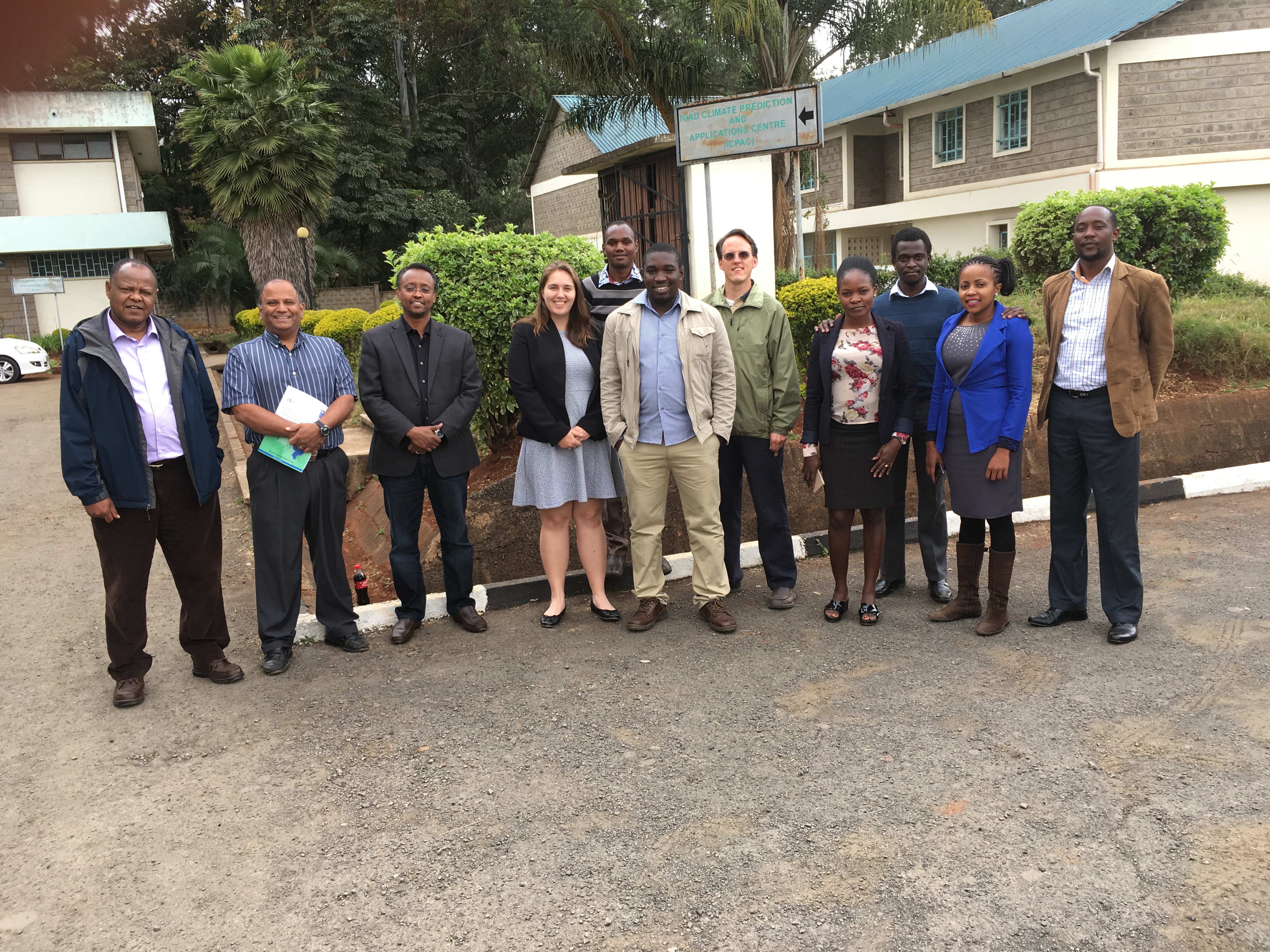 |
| From left, Zewdu Segele, Ashutosh Limaye, Guleid Artan (Director of ICPAC), Emily Adams, Anthony Musili, Allan Maungu, Jonathan Case, Maureen Anyango, Steve Omondi, Cynthia Wacuka, and James Wanjohi. |
Jonathan Case, a Research Meteorologist at ENSCO, Inc./NASA Short-term Prediction Research and Transition (SPoRT) Center, traveled to Nairobi, Kenya, to lead the training workshop, held 8-11 August 2016 and hosted by ICPAC. Five ICPAC participants and five RCMRD participants as well as Ashutosh Limaye and Emily Adams from the SERVIR Science Coordination Office* attended.
In addition to learning how to access and use the new datasets, ICPAC and RCMRD attendees learned how to use the SPoRT Model Evaluation Tool (MET) to gauge the accuracy of the forecasts produced.
“The training provided hands-on skills on the use of the most improved version of WRF UEMS,” says Anthony Musili, a climate downscaling assistant at ICPAC. “The model has high resolution terrestrial datasets … and therefore improves the representativeness of the complex land features of the Greater Horn of Africa.”
Steve Omondi, a developer with SERVIR-Eastern and Southern Africa, also recognizes the importance of the workshop.
“More than the knowledge enhanced while setting up the correct environment for WRF-UEMS to run, the model provides flexibility in configuration to study any number of weather related disasters that affect the region.”
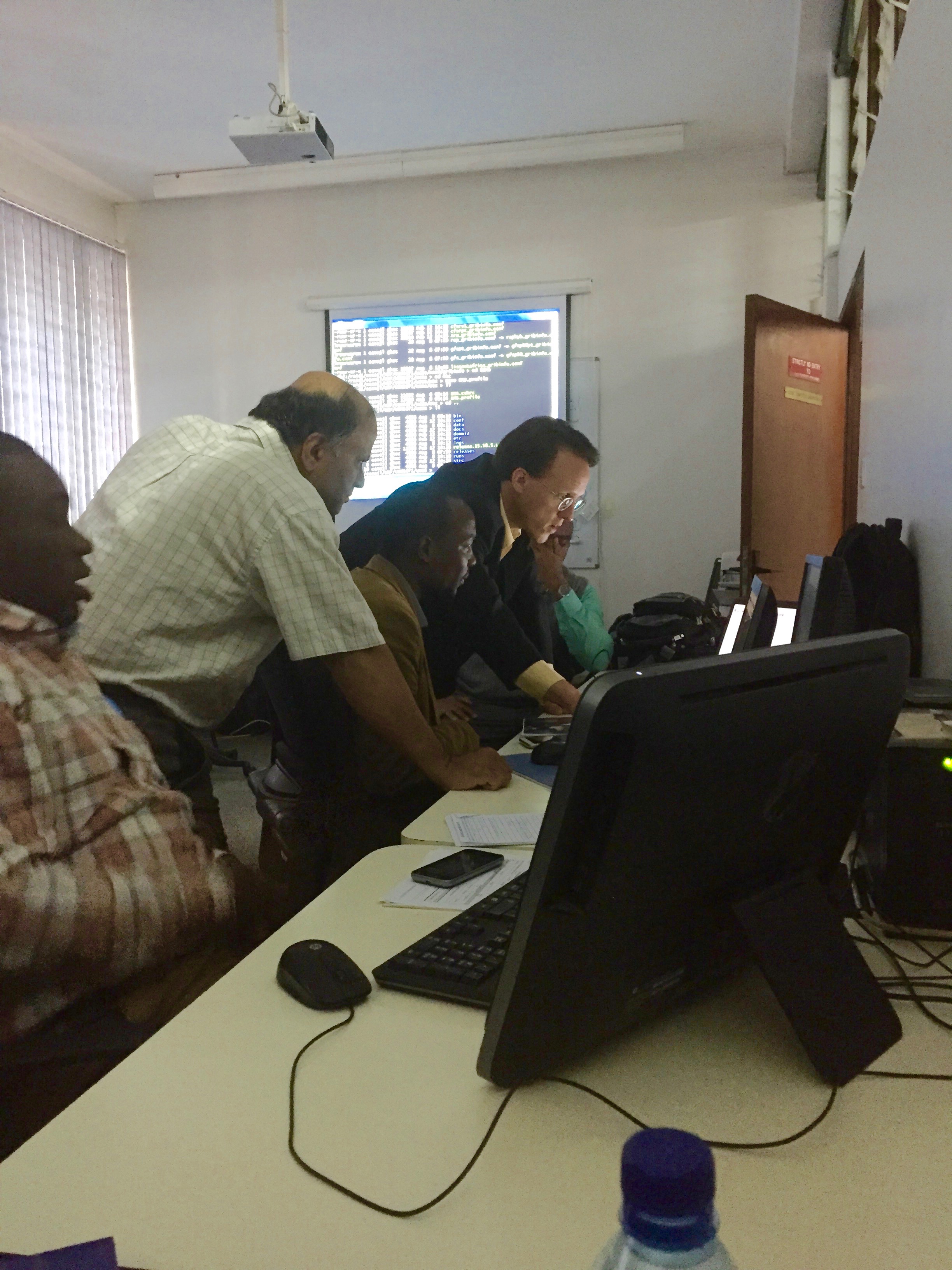 |
| SERVIR Project Scientist Ashutosh Limaye and SPoRT’s Jonathan Case demonstrate WRF model runs for RCMRD/SERVIR-Eastern and Southern Africa’s Allan Maungu, James Wanjohi, and Kenneth Mubea (pictured from left to right: Maungu, Limaye, Wanjohi, Case, Mubea) |
James Wanjohi of SERVIR-Eastern and Southern Africa adds, “At RCMRD, we now have the capacity and shareable knowledge on making WRF forecast and model verifications using SPoRT’s MET package. This is quite an important step towards enhancing RCMRD’s capability in providing early warning products.”
This workshop not only helped build the capacity for these institutions to produce better forecasts, but it also fostered a stronger relationship between the institutions. SERVIR-Eastern and Southern Africa hopes to use the datasets they learned to generate during this workshop as inputs into their flood simulations and frost forecasting models.
Content for this article was contributed by Denis Macharia and James Wanjohi of SERVIR-E&SA.
Notes:
- *The SCO is housed at NASA Marshall Space Flight Center in Huntsville, Alabama.
- LIS is a NASA-developed land-surface modeling and data assimilation framework. As a tool to produce land surface initial conditions for a forecast, it integrates satellite- and ground-based observational data products to better represent the characteristics of the Earth’s surface. This ground state, which includes variables such as temperature fluxes and soil moisture variations, can have a large influence on the transport of heat and moisture to the atmosphere. With more information on this transport, the WRF model has the ability to more accurately predict where and when rain will occur.
- Information on ground vegetation coverage specifically comes from the Green Vegetation Fraction (GVF) derived from VIIRS. This product provides information concerning the connection between transpiration (evaporation off of plants) and moisture in the atmosphere. GVF is generated by NOAA’s National Environmental Satellite, Data, and Information Service (NESDIS) (https://data.noaa.gov/dataset/nesdis-viirs-green-vegetation-fraction).