
Keeping a high-tech watch over green space
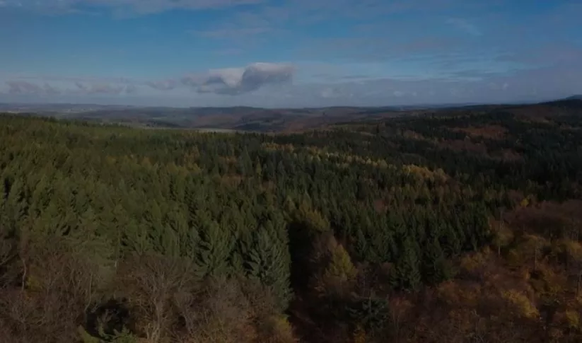
With state-of-the art satellite remote sensing techniques, countries can conduct accurate forest inventories as well as map and monitor land use change. Countries need accurate information about changes in their landscapes and in the extent and density of their forests in order to manage them effectively while balancing needs for sustainable development. It is critically important to measure and monitor our planet’s forests and green spaces, not only because they provide habitat for wildlife and sustain forest communities, but also because they take in large amounts of carbon and release oxygen.
 |
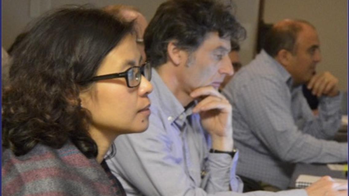
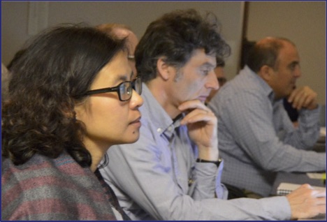
| SERVIR-Himalaya’s Capacity Building Specialist Rajesh Thapa (left) answers question posed by Sassan Saatchi, Senior Scientist with the Carbon Cycle Science Group |
Working to bring the best of such techniques to their hub regions, SERVIR is collaborating with SilvaCarbon, a U.S. government program* working to enhance capacity around the world in monitoring and managing forests. Together, these two programs are developing a training program, to be implemented in SERVIR hub regions, in the use of Synthetic Aperture Radar (SAR) data from the European Space Agency’s Sentinel 1A/B satellites along with optical data from the U.S.’s Landsat-7 and Landsat-8 satellites to keep track of biomass. The SERVIR/SilvaCarbon collaboration kicked off with a scoping meeting at the SERVIR Science Coordination Office (SCO) in Huntsville, Alabama, on 21 and 22 February 2017.
Representatives from the SERVIR Hubs in the West Africa, Eastern and Southern Africa, Mekong, and Hindu Kush-Himalaya regions; USAID; the US Geological Survey; the US Forest Service; and NASA; and subject experts from academia, government, and private industry attended.
“SilvaCarbon and SERVIR share the goal of building capacity for forest monitoring,” notes USAID’s Evan Notman, who leads SilvaCarbon. “This meeting is a start of closer collaboration between us, and of integration of NASA and hub work with our work.”
“Our aim is to bring the top science for forest biomass estimation to developing regions,” explains Africa Flores of the SCO. “We want our hubs to become centers of excellence for biomass estimation and land cover mapping to support their member countries. We envision our hubs implementing the methods specified in the document and supporting other countries in doing so.”
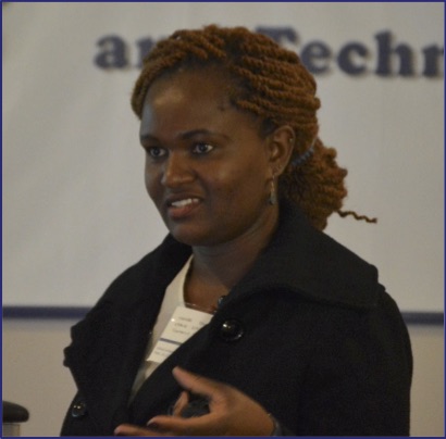 |
| Phoebe Odour, SERVIR-Eastern & Southern Africa Remote Sensing Specialist, addresses attendees |
A SAR is an airborne or spaceborne radar system that uses the flight path of the vehicle to simulate a very large antenna or aperture. The antenna on the aircraft or satellite directs its beam orthogonally (cross range or along track) to the direction of travel, transmitting radar (microwave) pulses sequentially towards the Earth’s surface, and collects the backscattered echoes sequentially from the ground targets. The data (phase and Doppler measurements) from these transmit/receive cycles is recombined and processed to form an image of the targeted terrain below by using different polarizations of the backscattered signals (based on the delay time of the backscattered signals).
SAR and optical datasets each have their own strengths and weaknesses but can complement one another. As a type of radar, SAR can “see” through clouds, gathering data rain or shine, night or day. Optical sensors, which operate by sensing the energy reflected from the Earth’s surface, cannot perform well in cloudy conditions or at night.
“Kenya has cloudy coastal areas,” notes Phoebe Odour of SERVIR-Eastern & Southern Africa. “We want to be able to integrate SAR data with optical data to map the land cover where the optical data is insufficient.”
SAR can also penetrate the vegetation canopies to provide forest structural information. So in addition to viewing the surface from the top, you can view the branches under that, or even bounce the signals off the trunks, depending on the frequencies of the SAR instruments (and their polarizations). In contrast, optical wavelengths are reflected off the tops of the trees, preventing a look at these characteristics.
“We need SAR data to discern forest structure to feed into the Regional Land Cover Monitoring System we are co-developing with our member countries,” says David Saah of SERVIR-Mekong. “It will support their carbon reporting.”
An advantage of Landsat (optical data) is that pre-processed georeferenced reflectance products at a global scale are available. SAR data, however, needs pre-processing. The SERVIR hubs will overcome this hurdle through training workshops facilitated by the SCO and SilvaCarbon.
The scoping meeting discussions and presentations will inform SERVIR’s development of a SAR Handbook and training materials to be incorporated at the hubs, as well as future guidance and capacity-building efforts by SilvaCarbon and others. Ultimately, this document could become a major contribution to SilvaCarbon and the Global Forest Observations Initiative (GFOI) to support national REDD+ Monitoring, Reporting and Verification (MRV) systems**.
 |
| Nguyen Hanh Quyen, SERVIR-Mekong; Alessandro Baccini, Woods Hole Research Center; David Saah, SERVIR-Mekong |
There will also be more training at the SCO in April for hub capacity building leads and remote sensing experts and other interested parties. In addition, focused training workshops on SAR data use for forest carbon and biomass estimation will be held at different hubs in the coming months.
Notes:
*Drawing on the expertise of eight U.S. agencies and other partners, SilvaCarbon helps developing countries design and implement systems for tracking and reporting forest change and terrestrial greenhouse gas emissions. Agencies currently involved include USAID, the U.S. Forest Service, the U.S. Geological Survey, the U.S. Environmental Protection Agency, the U.S. Department of State, NASA, the National Oceanic and Atmospheric Administration, and the Smithsonian Institution. SilvaCarbon is closely coordinated with international organizations and other governments that are engaged in related forest and terrestrial carbon activities, including GFOI.
**MRV of forest and terrestrial carbon, or biomass, is a critical capability not only for forest management, but also for REDD+ (short for Reducing carbon Emissions resulting from Deforestation and forest Degradation) reporting. REDD+ is a United Nations Framework Convention on Climate Change (UNFCCC) initiative that supports forest conservation by funding tropical countries in proportion to their efforts to protect forests and reduce greenhouse gas emissions, particularly CO2. Countries engaged with REDD+ need accurate information about the extent and density of their forests in order to assess their carbon stocks and potential for emissions to the atmosphere.
-
Estimating Forest Stand Height (FSH) with Synthetic Aperture Radar (SAR)
Synthetic Aperture Radar (SAR) is a useful technology for monitoring forests and estimating biomass since it provides information complementary to optical sensors, such as vegetation structur
-
SAR Handbook
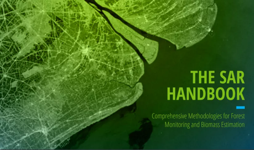
The SAR Handbook: Comprehensive Methodologies for Forest Monitoring and Biomass Estimation is the culmination of a two-year collaboration between NASA SERVIR and SilvaCarbon.

