
Marrying Data and Development: How SERVIR Helps Countries Manage Environmental Risks
While emerging scientific evidence suggests that wildfires are on the rise globally, Guatemala’s northern department of Petén, a forest area rich in cultural heritage and agricultural productivity, stands apart: the region has seen a decline in forest fires over the last decade.
The reason, according to a recent evaluation, is an improved system of forest fire prevention, control, and response, made possible through collaboration between Guatemalan agencies and SERVIR, a USAID-NASA partnership that uses Earth observation data to help developing countries address environmental challenges.
 |
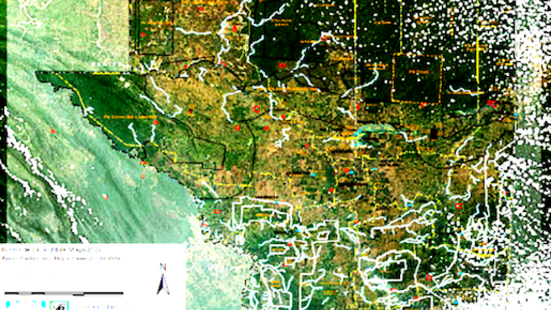
| A hotspot map distributed by Guatemalan officials to help monitor forest fires in the department of Peten. Photo: National Council for Protected Areas (CONAP) |
Working with Guatemala’s National Council for Protected Areas and other partners, SERVIR provided technical resources for satellite-based data products to monitor fires across Petén, where fire risk is projected to rise due to higher temperatures and longer dry spells.
Through the partnership, NASA satellite data started being integrated into Guatemala’s systems more than a decade ago to map hotspots – anomalies in ground surface temperature. The maps are still distributed daily during fire season to a forest fire management network comprised of first responders, government officials and NGOs managing the region’s many protected areas.
Guatemala’s experience is among nine case studies included in an in-depth evaluation of SERVIR. Preliminary results of the evaluation were shared at the Adaptation Community Meeting, held June 28 at The Wilson Center. A webcast of the event is available here.
The evaluation found that the NASA-USAID partnership, which began in 2005, reinforces the value of geospatial information in helping governments manage natural resources, prepare for and respond to disasters, and reduce food insecurity. Along with forest management, SERVIR also works on tools to monitor droughts, floods, agriculture production and land use.
“SERVIR products have a wide variety of positive social, economic and environmental impacts,” said Isaac Morrison, leader of the evaluation team. “They are used for strengthening and correcting other datasets, contributing to academic conversations, influencing decision-making, and improving disaster planning and preparedness. But above all, they are increasing leaders’ faith in data-driven decisions.”
An interesting element of the work was the use of valuation methodologies to put a dollar value on SERVIR services. In a case study on the Kenya Frost Forecasting Tool, for example, the evaluation determined that adding a a 72-hour prediction capability to the tool would help tea farmers to save approximately $84 annually, an amount equivalent to a month’s household spending on food.
The evaluation also highlighted the unique union of science and development in the NASA-USAID partnership. The provision of data or a data-based tool was not enough to guarantee success, the evaluation found; an enabling environment was also required to help country partners understand, use and apply the data to their daily work.
“The evaluation shows that the barriers to the use of data are often not technical, they are sometimes organizational or political, and in that sense the USAID-NASA partnership through SERVIR has been a successful experiment,” said Lawrence Friedl, Director of Applied Sciences at NASA.
The evaluation is being finalized for release later this year.
Erin Martin is an advisor for the SERVIR Support Team and the ATLAS Project. This blog was originally featured on Climatelinks, a global knowledge portal for USAID staff, implementing partners, and the broader community working at the intersection of climate change and international development. Click here to go directly to the webcast of the Wilson Center event.