
Mapping Charcoal Production to Protect Land in Ghana
Firewood and charcoal provide more than 80 percent of energy used in sub-Saharan Africa, according to the World Agroforestry Centre, with only a small volume produced sustainably. In Ghana, charcoal is a popular choice for cooking and heating in urban areas as it is locally available and by far the cheapest option when compared to electricity, kerosene, and cooking gas. However, since charcoal is produced from wood, forest resources are under increasing pressure because charcoal production has accelerated deforestation throughout the region.
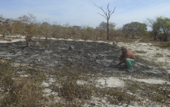 |
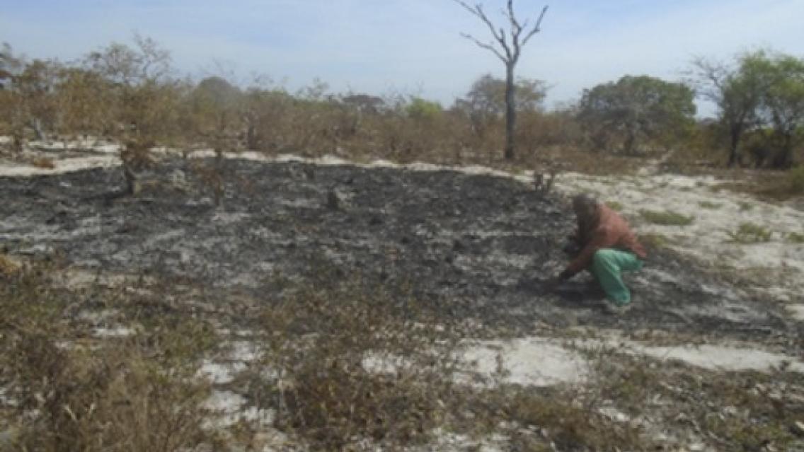
| Wood burning on a charcoal production site |
In the West Gonja and Sene districts of northern and central Ghana, respectively, deforestation caused by charcoal production is affecting sustainable livelihoods. Local communities and authorities lack adequate information to address the negative impacts of deforestation, such as the location and scope of current production sites. Although non-governmental organizations are supporting activities to develop sustainable charcoal production strategies, a significant information gap persists.
To address these challenges, the SERVIR-West Africa consortium member, Centre for Remote Sensing and Geographic Information Services (CERSGIS), is collaborating with local governments and non-governmental organizations to develop a charcoal production monitoring service. Using free and open source satellite data from NASA’s Landsat suite, current charcoal production sites are being mapped with pertinent information shared at the district government level for more informed environmental planning. This monitoring service will also incorporate a text messaging service for mobile phones to disseminate the location of approved production sites (and protected areas to avoid) to stakeholders in rural communities.
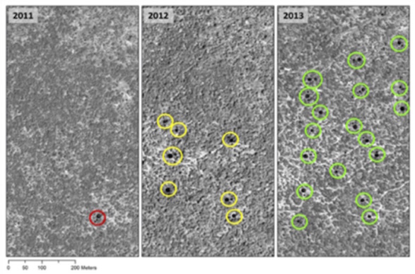 |
| Satellite imagery showing environmental degradation caused by the rapid increase of charcoal production sites (circled black spots) in the same location from 2011 to 2013. Fuel wood gathering around these charcoal production sites further compounds the environmental impact of this practice. |
“I am currently working on charcoal production site monitoring in West Gonja and Sene Districts of Ghana. The goal of this service is to use Earth observation technologies and reference data to identify and map charcoal production sites and develop a monitoring system to provide information for environmental planning at the district level.” Stella Ofori-Ampofo, Land Use/Land Cover Thematic Lead, SERVIR-West Africa/CERSGIS
The idea for developing this mapping service originated during a national consultation held in Accra, Ghana in 2016. During this meeting, the need for a charcoal monitoring service was identified as a key development priority for Ghana. Following SERVIR’s service planning approach, the service was developed according to the requirements identified by the stakeholders, with collaboration between the SERVIR-West Africa consortium partner CERSGIS, local non-governmental organizations, and government representatives. A prototype of this service will be tested in late 2018.
As this service is fully implemented, it is anticipated that the datasets and actionable information generated will improve local decision making on land management practices and policies that seek to minimize the environmental impact of charcoal production, rehabilitate degraded landscapes, and promote sustainable development to improve rural livelihoods.
