
Ensuring Resilience for People and Ecosystems: Guyana Advances Mangrove Monitoring with Satellite Technology
This post was written by Glenn Hyman (Spatial Informatics Group / SERVIR-Amazonia), Kerry Anne Kansinally (Conservation International Guyana), Kene Moseley (National Agricultural Research and Extension Institute, Guyana) and Andrea Nicolau (NASA SERVIR Science Coordination Office), and was originally featured on Agrilinks. Click here to go to the original blog post.
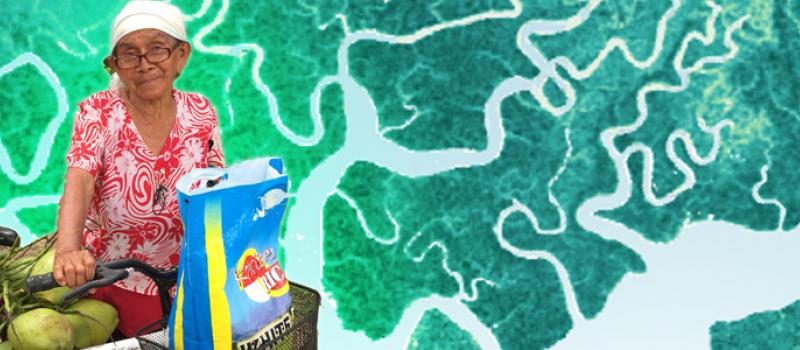
Photo by Maleka Russell, National Agriculture Research and Extension Institute, superimposed on satellite imagery of mangrove forests.
While mangroves ordinarily provide multiple benefits to Guyana’s coast, they are currently under threat due to rising sea levels, deforestation, and coastal erosion. Because mangroves assure coastal biodiversity and protection (see Figure 1), they play an important role in livelihoods and food security for residents and farmers. They provide invaluable environmental services such as fishery maintenance; flooding and saltwater intrusion mitigation; carbon sequestration; and timber and non-timber forest products provision.
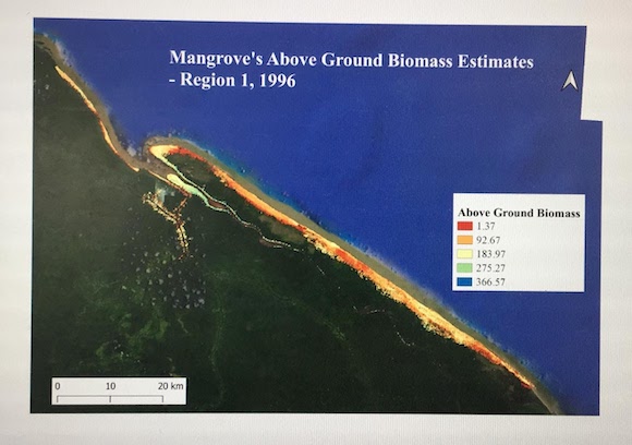 |
Figure 1: Map of above-ground biomass of a section of the Guyana coast, derived from tree height and trunk diameter at breast height estimates. Map courtesy of Haymawattie Danny, Guyana HydroMeteorological Service. |
In Guyana, almost 90 percent of the population lives along a narrow coastal belt that is responsible for nearly 95 percent of all agricultural produce consumed locally and exported and amounts to 15-42 percent of the country’s annual GDP. Guyana’s coast lies about 2m below sea level and is increasingly under threat due to sea level rise. Within the past five years, the Guyanese coastline has experienced several unusually high spring tides. These have breached coastal infrastructure and caused flooding, loss of productive rice and sugar lands, and increased risk of disease. It is, therefore, urgent that Guyana finds and implements solutions as threats to food security and livelihoods increase with rising sea levels.
While recent research has documented the extent and value of Guyana’s mangroves (GEF North Brazil Shelf Mangrove Project, 2019), the nation lacks systematic monitoring and reporting that tracks mangrove deforestation, restoration, and other changes in these dynamic ecosystems. Such a system is critical for government and civil society planning and action to protect mangrove forests, and in turn, the many protection and provisioning services mangroves provide.
A new initiative bringing Earth observation technology to sustainable development issues aims to address this gap. Guyana’s National Agricultural Research and Extension Institute (NAREI), the Guyana Forestry Commission (GFC), the Ministry of Public Infrastructure (MOPI), the University of Guyana (UG), Conservation International Guyana (CI Guyana), and other organizations are partnering with USAID and NASA’s SERVIR-Amazonia program to develop a new mangrove monitoring and reporting system based on satellite remote-sensing (Figure 2). Previous work has mapped Guyana’s mangroves using optical satellite platforms such as Landsat and Sentinel-2.
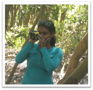 |
Figure 2: Reshana Thomas of the Guyana Forestry Commission using a laser range finder for measuring tree height in mangroves. Height measurements validate observations from satellite radar and calibrate biomass estimates, an important indicator of mangrove structure and health. |
The new system will build on important advances in mangrove remote sensing. First, it will overcome limitations of persistent cloud cover of optical platforms by using radar sensors, a satellite technology that penetrates clouds, reaching all the way inside the forest canopy. Second, the new initiative will aim to create a low cost and sustainable system for monitoring Guyana’s mangroves each year into the future. Radar and other satellite information are increasingly available as open science data in the public domain and on cloud computing platforms for easy access. The initiative’s GIS and remote sensing professionals will use open source technologies described in SERVIR’s SAR (Synthetic Aperture Radar) Handbook to develop map products and analyses for the monitoring system. An initial workshop in January of this year introduced partner organizations to Synthetic Aperture Radar to map mangrove and estimate biomass.
A second hands-on training will be carried out in late May and early June, where participants will develop the content of the monitoring system. Eight online sessions will use cloud computing resources provided by Amazon Web Services (AWS) and the Amazon Sustainability Data Initiative (ASDI) to process SAR data––producing maps on mangrove extent, tree height, biomass, and forest change. The training will be led by NASA Jet Propulsion Laboratory’s Marc Simard, a specialist in active remote-sensing for coastal zone research and development. This dedicated learn-by-doing approach uses satellite data and processing algorithms on AWS cloud servers, a time-saving alternative to working with huge radar data sets and complex software on PCs and local servers. The participants just need an internet connection.
The sessions will be aimed at producing the basic map products of the monitoring system and documenting the production methods, so they can be replicated on an annual basis. The maps and accompanying analysis will be shared on an inter-institutional website for use by government and civil society stakeholders working to protect mangroves. Ultimately, the initiative aspires to support larger efforts to protect and enhance (see Figure 3) the environmental services benefits to Guyana’s communities along its entire coast.
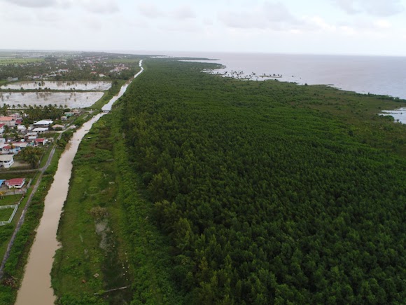
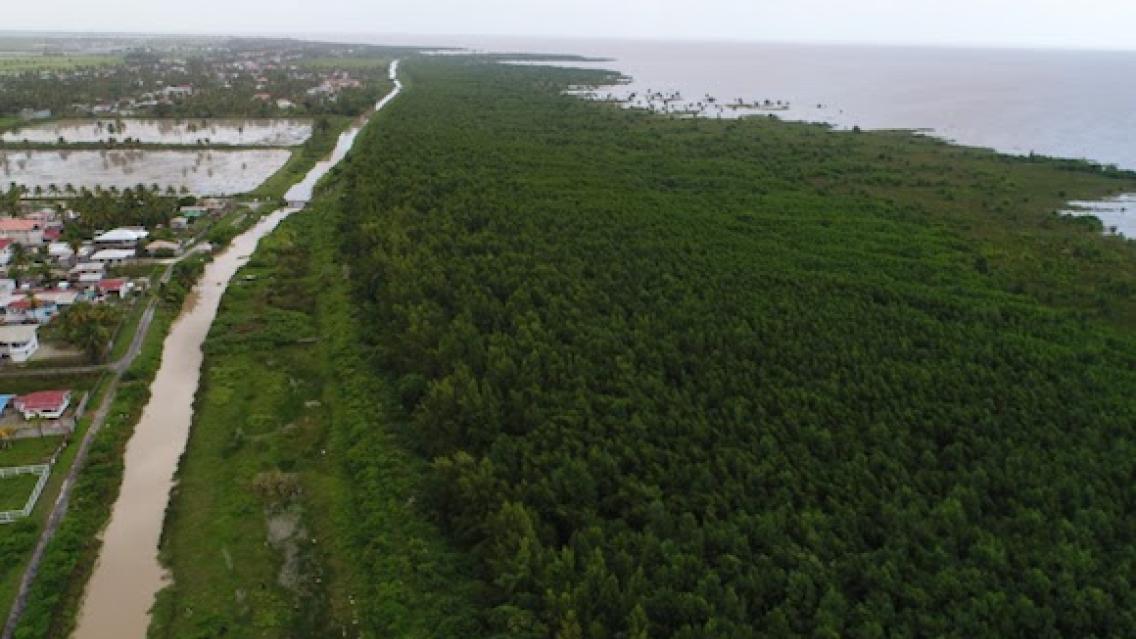
Figure 3: Restored mangroves along Essequibo Coast, Region No. 2, Guyana (NAREI)
