
Charting a new path for SAR applications in the HKH
Satellites provide a synoptic overview of our world. This overview is particularly useful in understanding our environments better. However, satellite data is voluminous; processing them for desired outcomes requires skilled users and high computational and storage capacity. Furthermore, optical satellite remote sensing requires cloudless, well-illuminated areas for quality data.
New advents in data access and sensor technologies have widened the scope of Earth observation in identifying changes on the Earth’s surface. Unlike optical remote sensing, Synthetic Aperture Radar (SAR) remote sensing penetrates cloud cover, is weather independent, and is especially advantageous for tracking and monitoring weather-related events such as floods and rain-triggered landslides. It can be useful in monitoring large disaster-prone areas over long periods of time. With cloud-based computational and storage facilities and machine-learning algorithms, SAR presents itself as a veritable data trove in mapping the environment and aiding informed decisions.
We partnered with the University of Alaska Fairbanks to organize a training titled HydroSAR: Extracting flood information from SAR to advance the use of SAR at ICIMOD and across the HKH region. The training was organized under our SERVIR Hindu Kush Himalaya Initiative and as part of the institutional capacity-building efforts of NASA’s SERVIR Applied Sciences Team.
The training introduced HydroSAR – a SERVIR Applied Sciences Team project that develops products, tools, and services to support monitoring hydrological hazards in the HKH region. HydroSAR, a cloud-based SAR data analysis service, taps into research expertise from the University of Alaska Fairbanks, the NASA Marshall Space Flight Center, the NASA Goddard Space Flight Center, the NASA Jet Propulsion Laboratory, and ICIMOD. The training also covered different concepts in SAR remote sensing, OpenSARlab flood extent and depth mapping, overview of computational algorithms, and archiving SAR data in the cloud.
A total of 23 professionals from national meteorological and hydrological services and research institutions in Bangladesh, Bhutan, Nepal, and ICIMOD participated in the remotely organized three-day training. Post training, several participants provided feedback on the HydroSAR platform, integrating SAR technology to their current work, and how the training can be improved.
Some excerpts are captured below:
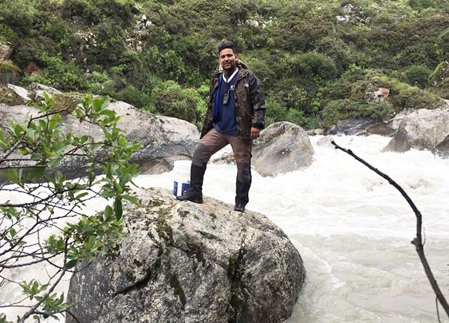
Amrit Thapa during a river discharge measurement field trip in Langtang River near Langtang Village in
Rasuwa District, Nepal. ICIMOD researchers have been taking in situ measurements in Langtang River and the
Langtang Valley for the past 10 years under ICIMOD's Cryosphere Initiative. (Photo credit: Gyalbu Tamang)
HydroSAR provides state-of-the-art Earth observation data and a set of standard rules to generate data products and both flood extent and depth maps. The cloud-based computational environment also facilitates big-data processing within a few hours. Using HydroSAR, we can generate high-quality flood extent and depth maps in near real-time to support local disaster management partners. The HydroSAR platform has built-in Radiometric Terrain Correction, which is crucial for improving reliability and accuracy relevant for time-series analysis of environmental variables like permafrost, snow cover, forests, and agricultural land. The HydroSAR system also streamlines the processing effort by negating the need to process voluminous SAR datasets, which has always been a complex, time-consuming process.
Persistent cloud cover poses a major challenge while trying to understand long-term cryospheric changes in the HKH using optical remote-sensing data. Since SAR is an active sensor, it penetrates cloud cover and provides continuous datasets even during the night. This is useful to better understand cryospheric changes and processes in the HKH region.
– Amrit Thapa, Remote Sensing and Geoinformation Analyst, ICIMOD
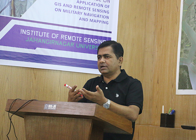
Sheikh Tawhidul Islam during a training course on the applications of GIS and remote sensing on military
navigation and mapping at the Institute of Remote Sensing, Jahangirnagar University, Bangladesh
The HydroSAR training opened up new avenues on how radar remote-sensing techniques could play important roles during the monsoon, when optical remote sensing is affected by cloud cover. As SAR signals are also sensitive to soil moisture, SAR could help us understand drought conditions better. SAR data could help us monitor our wetlands – characterize wetland habitats, assess the conditions of dependent biotic communities, and monitor intra- and inter-seasonal changes in water depth.
The training also introduced potential applications of SAR data, especially in examining hydro-meteorological hazards. Flood early warning systems in Bangladesh provide 10-day probabilistic and 5-day deterministic flood forecasts. SAR data in combination of satellite altimeter data could help us further improve the lead times in our flood forecasts. Such improvements will bring about huge benefits by saving lives, property and public infrastructure.
– Sheikh Tawhidul Islam, Professor, Institute of Remote Sensing, Jahangirnagar University, Bangladesh

Binu Maharjan works on flood modeling and forecasting, setting up an operational flood forecasting system in
river basins, flood inundation mapping, and evaluating the performance of flood outlooks at ICIMOD.
(Photo credit: Jitendra Raj Bajracharya/ICIMOD)
HydroSAR could add value to ICIMOD's existing flood information services, such as the Regional Flood Outlook and HIWAT Streamflow Prediction Tool – Nepal. Information on flood inundation and depth tapped off SAR data could be used to create visually appealing, informative maps to be shared with users along with discharge information. For a flood modeller like me, it will be interesting to compare the flood inundation data generated from HydroSAR and different flood models.
– Binu Maharjan, Flood Modeller, ICIMOD
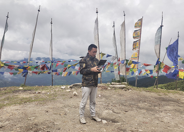
Tandim Wangchuk operates a drone for an aerial survey of Chelela Pass. The survey was carried out to generate
digital elevation models and orthophotos for the area. (Photo credit: Jamyang Zangpo/NCHM)
HydroSAR would immensely benefit NCHM in producing reliable flood mapping in a very short time. We can extract relevant information on water bodies, vegetation, soil moisture, and other parameters from SAR data. As SAR data has very good spatial and temporal resolutions, data obtained from SAR are precise, high resolution, and consistent. Besides mapping floods, HydroSAR can be used to generate raster data. OpenSARlab automates processing and analysis of SAR data, which greatly reduces the time and effort required. A longer in-person focused training on customization of different HydroSAR products would be very helpful.
– Tandin Wangchuck, Deputy Executive Engineer, National Center for Hydrology and Meteorology (NCHM), Bhutan
More information
A separate follow-up event captured how participants used SAR data and the cloud computing environments to solve real world problems in their respective professions. The discussion can be viewed here. Training resources – PDF copies of the PowerPoints and recordings of the sessions – can be accessed from the event page on the SERVIR Hindu Kush Himalaya website.
Written by Utsav Maden of SERVIR-HKH/ICIMOD. This article was originally featured on SERVIR-HKH's website. Click here to go to the original post.
