Announcement NASA Announces New SERVIR Applied Sciences Team After a multi-round solicitation process, NASA has selected the 20 projects comprising the next SERVIR Applied Sciences Team. November 1, 2019
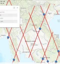
Articles & Stories Mekong River Commission Utilizes Space Technology to Improve Flood Forecasting Lower Mekong countries suffer from the effects of seasonal flooding and flash flooding caused by monsoon rains and tropical storms. Regional and national level organizations and agencies require a range of information, forecasts, and decision-support tools to better prepare for, monitor, issue warnings, and respond to flood risk. August 8, 2019
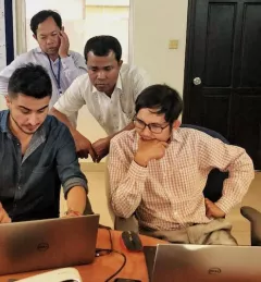
Articles & Stories Cambodian Youth Learn and Connect Geospatial Pieces For a second year, the SERVIR-Mekong program held an exhibition booth as part of the U.S. Government pavilion at Cambodia’s Science and Engineering Festival Exposition and Workshop (CSEF). February 28, 2019
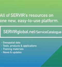
Articles & Stories SERVIR Launches Service Catalogue of User-Tailored Geospatial Services The newly-launched SERVIR Service Catalogue is improving access to geospatial services to inform decision making and improve resilience in critical areas like food security, water management, disaster resilience, and sustainable land and ecosystem management. February 10, 2019
Articles & Stories Monitoring Rainfall and Water Levels from Space In recent years, weather-related disasters such as floods and storms have become frequent in the Lower Mekong Region. According to the United Nations Office for Disaster Risk Reduction, from 1995 to 2015, almost half of all the disasters across the globe were floods, which affected 2.3 billion people. The majority of these events occurred in Asia. December 13, 2018