Strategy & Guidance USAID Geospatial Strategy USAID’s 2024-2028 Geospatial Strategy promotes leveraging the power of geospatial data and technology to target the delivery of international programs. November 15, 2023
Fact Sheet Fact Sheet: SERVIR Southeast Asia This fact sheet outlines how the SERVIR Southeast Asia (SEA) Regional Hub uses publicly available satellite technologies to support regional institutions, governments, and communities adapt to transboundary climate issues and mitigate the impacts of climate change. August 31, 2023
Tool SERVIR Gender Analysis Tool This Gender Analysis Tool provides clear guidance on a foundational step for service design and programming, to contribute to SERVIR’s goals of ensuring that women, along with men, are realizing equal benefits from SERVIR’s geospatial services. March 6, 2023
Use Case Use Case: Greening Prey Lang Greening Prey Lang, a USAID program, used Collect Earth Online (CEO) as part of their efforts to protect critical forestland in Cambodia and improve the lives of the people who live there. February 17, 2022
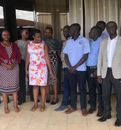
Use Case Use Case: Uganda Directorate of Water Resources Management The Uganda Directorate of Water Resources Management manages and develops Uganda’s water resources in an integrated and sustainable manner. January 20, 2022