
Investigating Lemthang Tsho (Lake) outburst in Bhutan
On 28 June 2015, around 7 pm local time, a yak herder in Bhutan witnessed an alarming spectacle: a glacial lake outburst flood, or GLOF. He looked on as water from Lemthang Tsho (Memari) Lake, which had filled beyond capacity, burst over its embankment.
An early warning system installed in the Puna-Tsang Chu valley was sounded, to alert the communities of impending danger. But many in Bhutan were still concerned about residual hazards and risks from other glacial lakes.
The Department of Hydro-Met Services in Bhutan asked for assistance from the International Centre for Integrated Mountain Development (ICIMOD) in (1) scientifically documenting the causes, process, evolution, and effects of this lake outburst; and (2) assessing potential GLOF hazards from glacial lakes in the adjoining valley.
In response, experts from ICIMOD joined the Bhutanese team in investigating the lake, which is situated in the Mo Chu catchment 4230 meters above sea level.
GLOFs often gush down the Himalayas’ mountain valleys with disastrous results – a great deal of damage and some loss of life in downstream villages. GLOFs could occur more frequently as climate change speeds glacier melt. It is important to learn as much as possible about these events and the dynamics behind them.
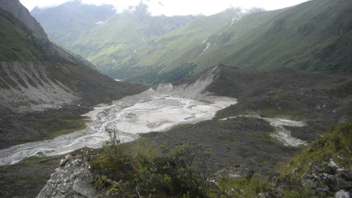
“The (Lemthang Tsho) lake burst was triggered by a sudden drainage of two interconnected supraglacial ponds (ponds of water that formed on the glacier) at the headwater of the lake,” said Samjwal Bajracharya, ICIMOD’s Remote Sensing Specialist. He noted that the lake outburst emptied Lemthang Tsho, leaving behind a glacier-fed stream in its place.
 |
| GLOF Research Teams in the field |
The GLOF investigation team said that overflow of the supraglacial ponds increased the discharge from Lemthang Tsho starting at 3 pm on June 28. The increased water discharge caused channel erosion, widening the lake’s outlet to 30 meters and displacing big boulders in the moraine, resulting in the GLOF. The outburst washed away four cantilever bridges and some horse trails, and it also activated a landslide downstream.
The river swelled to 250 centimeters during the flood. For reference, this was over 2 meters higher than the previous reference river discharge of 38.76 centimeters at the end of July.
The assessment team also found that the other three lakes located in the vicinity did not pose any risk of glacial lake outburst flood. Two lakes in particular, Latshokarp and Langdo Latshokarp, which were previously listed as potentially dangerous glacial lakes in an ICIMOD report (2011), have now been removed from the list.
 |
| Debris brought down by the flood |
The findings were presented to the Minister of Economic Affairs and stakeholders from different government agencies during a workshop held on 14 August 2015 in Thimphu, Bhutan.
ICIMOD’s support for this activity came through the SERVIR-Himalaya Initiative and Cryosphere monitoring program. SERVIR is a joint development initiative of USAID and NASA, working in partnership with leading regional organizations around the globe. SERVIR-Himalaya is implemented by ICIMOD.