

Water security is critical to eradicate poverty and to achieve gender equality, food security, and ecosystem conservation. Climate change and population pressures are amplifying impacts of water-related stressors and shocks, threatening the availability of water for irrigation and household use. Competing demands for freshwater both within nations and across borders pose challenges for water security and international diplomacy and can further marginalize vulnerable groups.
Through Earth observations-driven services and capacity strengthening, SERVIR helps partners increase sustainable access to freshwater and promote cooperation on shared waters.
Earth observation data can play an important role in monitoring and forecasting the availability and quality of water, including groundwater. Hydrologic models provide historical, near real-time, and forecasted data on river levels and streamflow. These tools inform the availability, seasonality, and short- and long-term changes in water, whether for human consumption, irrigation, or reservoir management. Satellite- and model-based estimates of surface water extent can give critical snapshots of conditions in water bodies large and small. For example, some SERVIR services help pastoralists locate small seasonal watering holes for their herds, others help monitor flood conditions across large international watersheds like the Mekong River.
Long-term understanding of water trends guides authorities in designing, allocating, and operating water use projects. Observations and models of surface water quality can also inform monitoring and management decisions to protect and restore water from pollutants and algal blooms. Combining satellite and ground measurements can also provide information on the status of aquifers and groundwater extraction and recharge.
-
Improving Resilience and Reducing Risk of Extreme Hydrological Events
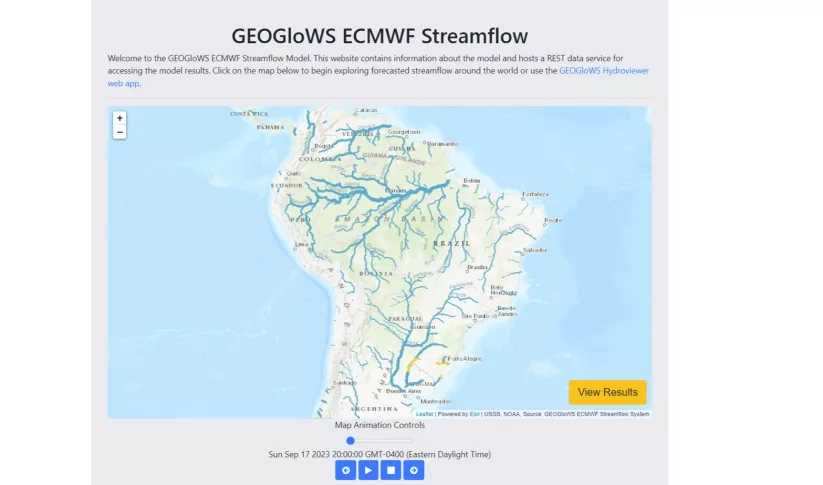
The Improving Resilience and Reducing Risk of Extreme Hydrological Events service provides stakeholders in the Amazon Basin region with improved historical water information and a flood forecasting ability to support greater resiliency to flood disasters.
-
Monitoring Ephemeral Water Bodies in Ferlo, Senegal

The Monitoring Ephemeral Water Bodies in Ferlo, Senegal Service is a web-based platform for assessing water availability in all known ponds, thus facilitating water management in arid areas such as the Ferlo Region of Senegal.
-
Regional Stream Flow Monitoring and Forecasting Service
The Regional Stream Flow Monitoring and Forecasting Service was designed to provide real-time streamflow forecasts for several watersheds in East Africa and bias-corrected satellite precipitation products to enable the timely prediction and monitoring of extreme events.
-
Satellite-Based Water Quality Monitoring Service
The Satellite-Based Water Quality Monitoring Service leverages Earth observing satellite information to assess historical water quality changes of in-land trans-boundary lakes.


-
Turning Data into Action: Three Ways SERVIR is Strengthening Water Security
Disaster preparedness and the water resource management require reliable and timely information. In many regions of the world, ground observation data is scarce. Here are three ways that SERVIR's innovative services and tools enable decision-makers and authorities to address water challenges.
-
Keeping Guatemala’s Lake Atitlán Crystal Clear

Nestled in between soaring green mountains, Guatemala’s Lake Atitlán is renowned as one of the most beautiful lakes in the world. It has also been under threat by massive blooms of algae clotting its pristine waters. In 2009 and 2015, massive “blooms” of algae threatened to cause severe ecological damage.
-
Satellite Data, Applications Flowing Through SERVIR to Southeast Asia

More than 50 million people in Vietnam, Cambodia, Thailand, Laos, and Myanmar draw water for drinking and agriculture from the Mekong River.


-
Use Case: Uganda Directorate of Water Resources Management (DWRM)
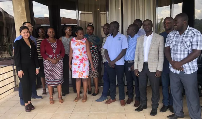
The Uganda Directorate of Water Resources Management manages and develops Uganda’s water resources in an integrated and sustainable manner.
-
Use Case: Vietnam Academy for Water Resources (VAWR)
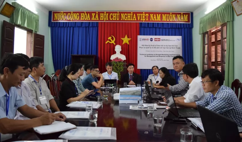
VAWR, which operates under Vietnam’s Ministry of Agriculture and Rural Development (MARD), is the leading institute for water resources, research and development within Vietnam.
-
Use Case: Nepal Department of Hydrology and Meteorology (DHM)
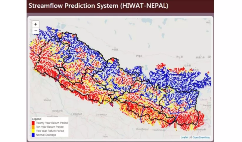
The Nepal DHM is the national agency responsible for monitoring and managing the hydrological resources of Nepal. This Use Case describes how they used the SERVIR Enhancing Flood Early Warning Services (EWS).
-
Use Case: Bangladesh Flood Forecasting and Warning Centre (FFWC)
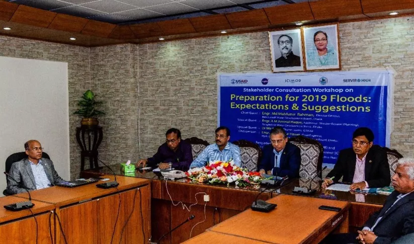
Enhancing Flood Early Warning Services aims to build the resilience of vulnerable communities in the Hindu Kush Himalayan region by increasing flood forecast lead times that are hosted on an interactive web platform.


