
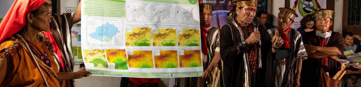
SERVIR Amazonia, an initiative of USAID and NASA, addresses environmental and development challenges across the Amazon Basin using state-of-the-art geospatial technologies. The ultimate goal is to improve local capacity to harness satellite data and geospatial information to foster sustainable natural resource management throughout the Amazon.
For this purpose, SERVIR Amazonia empowers actors across the region to track environmental changes in near real-time, evaluate climatic threats, etc., in four thematic areas: Drought and Fire Risk, Water & Water Related Disasters, Weather and Climate, and Land Cover, Land Use Change & Ecosystems.
Implementer: The SERVIR Amazonia Program is implemented by a consortium led by the Alliance of Bioversity International and the International Center for Tropical Agriculture (CIAT). Other members include:
- Institute of Agricultural and Forest Management and Certification (Imaflora) in Brazil
- Conservación Amazónica (ACCA) in Peru
- Fundación EcoCiencia in Ecuador
- Spatial Informatics Group (SIG) in the United States
The consortium members work through their networks to increase the quality, access, and use of geospatial information at the regional level. Services are developed in collaboration with multiple stakeholders, including Indigenous communities, women, and other marginalized groups.
Countries: Brazil, Colombia, Ecuador, Guyana, Peru, and Suriname
More about the implementing partners
The Alliance of Bioversity International & CIAT, based in Cali, Colombia, addresses development needs through research and international partnerships. The Alliance delivers research-based solutions that harness agricultural biodiversity and sustainably transform food systems to improve people’s lives. With novel partnerships, the Alliance generates evidence and mainstreams innovations to transform landscapes so that they sustain the planet, drive prosperity, and nourish people.
The Spatial Informatics Group - SIG, a U.S.-based environmental think tank, brings together scientists with expertise in geospatial analysis, environmental, and socioeconomic sciences. SIG’s goal is to help stakeholders make informed management, land use, and policy decisions by converting spatial data into knowledge that they can use in a world with ever-changing environmental conditions. The think tank provides a wide range of geospatial expertise in areas such as ecology, forestry, wildfire risk and hazard management, environmental economics, urban and regional planning, natural resources, water resource management and ecosystem functions.
Conservacion Amazonica - ACCA, is a Peruvian non-profit organization that has been an innovative leader in Amazonian conservation, research, and biodiversity management initiatives since 1999. Its mission is to protect the most diverse landscapes on the planet, train the next generation of conservationists, and strengthen sustainable livelihoods. ACCA is headquartered in Lima and has regional offices in Madre de Dios and Cusco. It operates three world-class biological research stations that offer a unique altitudinal gradient from cloud forest to foothills to lowland Amazon plain.
The Institute for Forest and Agriculture Management and Certification - IMAFLORA, is a non-profit, non-governmental Brazilian organization created in 1995 to promote the conservation and sustainable use of natural resources and to generate social benefits in the forestry and agricultural sectors. Its work focuses on ecosystem management and biodiversity protection through analysis of how human activities impact on ecosystem services. Imaflora provides a wide range of environmental expertise to support local sustainable development policies in communities and protected areas and its work focuses on climate-resilient agriculture and forestry to adapt to and mitigate the impacts of climate change.
Fundación EcoCiencia - ECOCIENCIA, is an Ecuadorian, private and non-profit scientific entity, founded with the aim of generating high-quality information for making the best decisions in favor of biodiversity conservation and the welfare of the population. EcoCiencia supports, shares and works through alliances with local sectional governments, municipalities, provincial councils, local NGOs and community or grassroots organizations, in search of solutions to the socio-environmental problems of Ecuador.
-
Forecasting Seasonal to Sub-Seasonal Fire and Agricultural Risk from Drought
The Forecasting Seasonal to Sub-seasonal Fire and Agricultural Risk from Drought service provides information for evaluating drought conditions at temporal and spatial resolution to predict fire vulnerability in the Amazon basin.
-
Improving Resilience and Reducing Risk of Extreme Hydrological Events
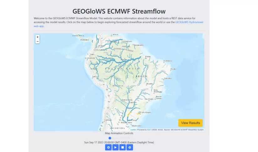
The Improving Resilience and Reducing Risk of Extreme Hydrological Events service provides stakeholders in the Amazon Basin region with improved historical water information and a flood forecasting ability to support greater resiliency to flood disasters.
-
Monitoring of Gold Mining in the Peruvian Amazon
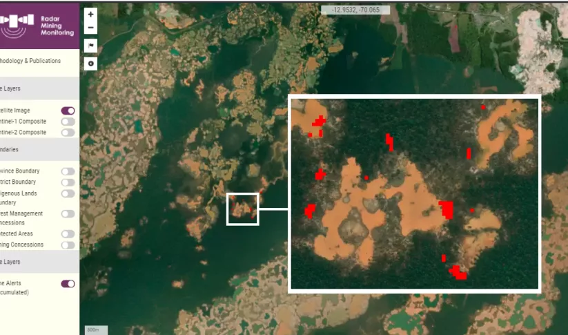
The Monitoring of Gold Mining in the Peruvian Amazon service produces near real-time information on deforestation and mining activity in the southern Peruvian Amazon.
-
Monitoring of Mangroves in Ecuador
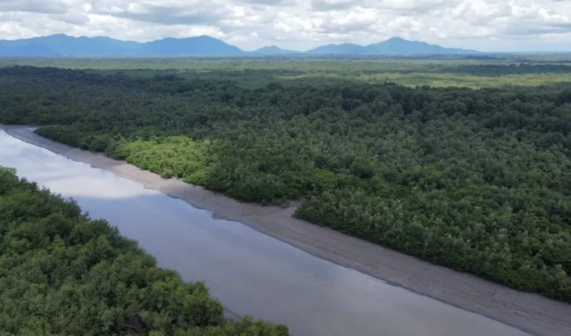
The Spatio-temporal monitoring of the mangrove ecosystem, in collaboration with the CIIFEN, generated a Google Earth Engine code to support the monitoring of mangrove change.


-
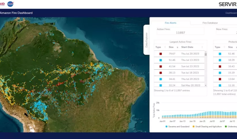
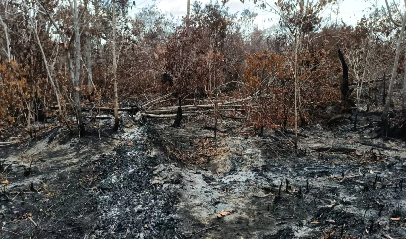
Managing fire risk in the Amazon ahead of an El Nino year
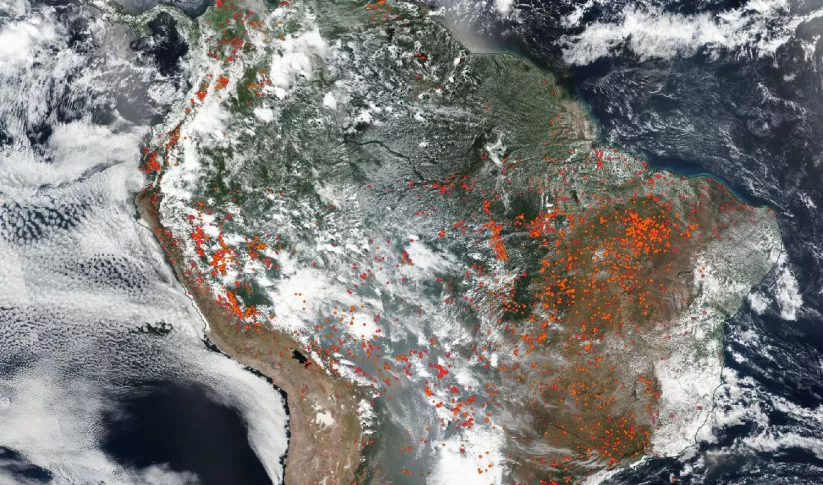
The Amazon Rainforest, often referred to as the "lungs of the Earth," plays a vital role in global climate regulation and biodiversity preservation.
-
SERVIR Amazon Fire Tracking Tool Revamped Ahead of El Niño
This dry season, communities in the central and northern Amazon face increased fire risk linked to El Niño. With the support of SERVIR, decision-makers can more easily track and respond to these fires.
-
NASA Administrator visit to SERVIR Amazonia Highlights Climate Efforts

On August 3, NASA Administrator Bill Nelson and former U.S. Senator Kay Bailey Hutchison visited the joint campus of the Alliance of Bioversity International and International Center for Tropical Agriculture (CIAT) in Palmira, Colombia.


-
SERVIR Service Planning in Action
This collection of case studies is a companion to the SERVIR Service Planning Toolkit. It provides concrete examples from SERVIR’s experience, and that of our partners, applying the Service Planning approach.
-
Mapping and Monitoring Mangroves using Google Earth Engine

This workshop is the third in a series offered by SERVIR Amazonia focused on using remote sensing to monitor mangroves in Guyana.
-
SERVIR Strategic Plan 2020-2025

This strategic plan identifies the next set of cross-cutting strategic priorities that will ensure SERVIR remains responsive to both NASA and USAID Agency goals and those of stakeholders and users in SERVIR regions.


