
ITC Intern Highlights

Earlier this year, SERVIR welcomed two virtual interns from the University of Twente’s International Institute for Geo-Information Science and Earth Observation in Enschede, the Netherlands. The program, better known as ITC, is one of the world’s leading geospatial education programs and is known for attracting students from around the world. Since 2018, it has been a key partner in SERVIR’s mission to build global geospatial and Earth science skills. Tracy Chepkorir and Sachita Shahi were the inaugural class of a virtual ITC-SERVIR internship, each undertaking 10-week projects to support SERVIR services while getting to work with our global network of geospatial scientists. Tracy and Sachita recently wrapped up their projects and shared their experiences with us. Read on to learn more about their experiences conducting the very first ITC-SERVIR internship projects.
Tracy Chepkorir
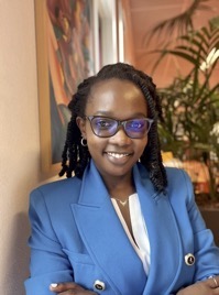
For Tracy Chepkorir, pursuing geospatial engineering and working with SERVIR were appealing because the path allowed her to broach issues that were “physically and emotionally close to home.” Working with the Science Coordination Office’s Eastern & Southern Africa team—Emily Adams, Sara Miller, and Dr. Vikalp Mishra—Tracy’s project evaluated the drought detection methods of Kenya’s Regional Drought Management Authority.
“I am from Kericho in Kenya, and I grew up in a village that farms tea and maize. I have grown conscious of the rain intensity and frequency change over time and witnessed its impact on the production of maize,” Tracy said. “It is unfortunate to see the immense impact of drought […] on the local population. The internship allowed me to apply my knowledge and skills to improve the situation in my home country.”
Tracy collected several indicators commonly used in remote sensing to assess drought potential and measured the performance of each for multiple droughts that occurred in Kenya in the 2010s. Looking at several measurements common in drought research—standardized precipitation, anomalies in evapotranspiration, and vegetation health—Tracy and the team were able to better understand which variables were reliable in detecting droughts. Some of the variables—like Evaporative Stress Index and Normalized Difference Vegetation Index—could even reliably predict droughts before conditions became severe.
“I learned a lot working with experienced mentors,” Tracy said of the experience. “One of the rewarding parts of the project was learning new state-of-the-art geospatial analysis and visualization techniques such as Python scripting. Another rewarding thing was seeing the project's output and presenting it to the SERVIR team in the SCO office and in Kenya.”
Sachita Shahi
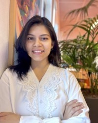
Sachita Shahi, whose background is civil engineering, began exploring geospatial science as a way of getting ready for a career in transportation engineering. Whether it’s engineering safer roads or studying the natural world, she points to the sheer scope of possibilities as one of the reasons she wanted to add geospatial research to her skillset.
“I wanted to step outside my knowledge field and see how much new information and concepts I could grasp in such a short interval of time,” Sachita said. “I also wanted to do an internship that was totally different from my thesis topic. This seemed like a perfect opportunity to take on the challenge.”
With SERVIR mentor Tim Mayer, Sachita helped SERVIR Hindu Kush-Himalaya refine its Regional Drought Monitoring System for Pakistan. By exploring multiple methods for quantifying drought severity in the region, she helped the hub better understand how the severity of drought is often driven by different circumstances depending on the region and time of year. Building off of previous SERVIR work that compared the results of different methods for the same regions in the same months, Sachita helped the team better understand the nuances of how drought can manifest itself in different ways–not only as a function of rainfall alone, but as also a shift in variables like temperature, soil conditions, and vegetation health. Better recognizing and communicating these variables will help the Regional Drought Monitoring System provide more specific and useful information to communities in Pakistan. Sachita’s project prioritized examining conditions most relevant for wheat harvests, helping the results be more relevant to supporting the food security and economic resilience of communities. She even pointed out ways that the system could be used to set standards for public drought warnings.
“I had never presented to so many people before, and these were people who were on top of the workforce, and had been experts for many years,” Sachita said. “Getting my work acknowledged by them made me feel proud of myself and gave me the courage to believe in myself for future endeavors.”
Looking back on their projects, Tracy and Sachita had advice to share for future ITC-SERVIR interns.
Tracy recommends making sure to talk to mentors frequently for support:
“In my experience, they gave key advice to achieve better results and reach the internship goals. Also, they helped me develop my professionalism in an international network of experts in the geospatial sciences.”
Sachita recommends that future interns not be afraid to take risks, but also highlighted the importance of mentor support:
“My one and only advice is: Don’t be afraid of the unknown, go for it, and you will get all the help you need along the way!”