
Serving Governments' Climate Data Needs
This post was written by Christine Chumbler and was originally featured on Climatelinks. Click here to go to the original blog post.
Farmers around the world increasingly rely on long-range weather forecasts when planning their crops. Traditional timing for planting is no longer as reliable as it used to be, and neither are the rains, thanks to shifts in climate patterns. Where can farmers turn for trustworthy information on expected rainfall? Their governments are a logical source, but often they haven’t been able to provide much more than the farmers themselves already had.
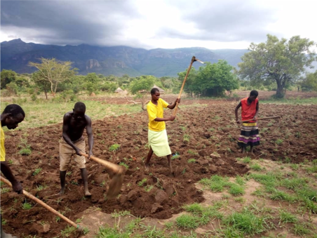 |
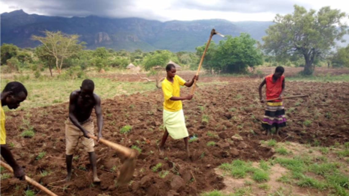
| The SERVIR-Eastern and Southern Africa Hub has been working with the governments of Kenya and Tanzania to improve their ability to accurately forecast drought vulnerability. Here, farmers who have been waiting for rain prepare their fields for planting. |
“Timely information on local conditions is essential, whether that’s weather information or agriculture information or forest information or disaster information,” explains Jenny Frankel-Reed in USAID’s Global Climate Change Office. “We’re working in places that need good information to inform their development plans, but resources for monitoring are lacking.”
Raw data alone doesn’t solve the problem; analysts must also know how to work with that data to derive trends or predictions that are useful for management and planning. “In several instances that I’ve come across, an agency has very good monitoring data but then the staff that are supposed to work with that data do not have sufficient skills,” says Denis Macharia, Weather and Climate Lead with the Regional Centre for Mapping of Resources for Development in Nairobi. “Those two have to go together.”
This is where SERVIR comes in. Since 2005, the collaboration between USAID and NASA has been steadily building the capacity of scientific organizations, government officials, and communities across the developing world to better handle environmental challenges and more effectively inform resilient development. It seeks to deliver near-real-time environmental data from Earth-orbiting satellites to data-scarce communities and scientists, and to transfer knowledge from U.S. scientists and development experts to partners abroad, equipping them with the skills and information needed to handle environmental challenges as they arise, and become more self-reliant to manage risks and land use.
But this is not a case of scientists parachuting into a country to hand off models or reports. SERVIR’s service planning approach brings partners, stakeholders, and end users into the design process from the very beginning, even before solutions are discussed. Through its five regional hubs, SERVIR first holds detailed conversations about needs on the ground. “Within what we call the Service Planning Toolkit, there is a process where local stakeholders and scientists explore the challenges on the ground together, before we start considering the solution,” says Macharia, a member of the team at SERVIR’s Eastern and Southern Africa Hub. “And once we conceived that solution, then we look back at what we have in SERVIR that can respond.”
The toolkit contains four tools: consultation and needs assessment; stakeholder mapping; service design; and monitoring, evaluation and learning. It also includes practical guidance on how to engage users at each phase, as well as templates for service design, development of a theory of change, sample agendas and activities, and guidance for visualizing and reporting information.
The SERVIR-Mekong Hub in Southeast Asia has also used the service planning approach to great effect. “We know we have the tools, we have the technology, but we don’t know what they need yet,” says Ekapol Sirichaovanichkarn, SERVIR-Mekong Monitoring and Evaluation Lead, describing initial consultations with government agencies regarding potential support. “So we go into each country and talk to them.”
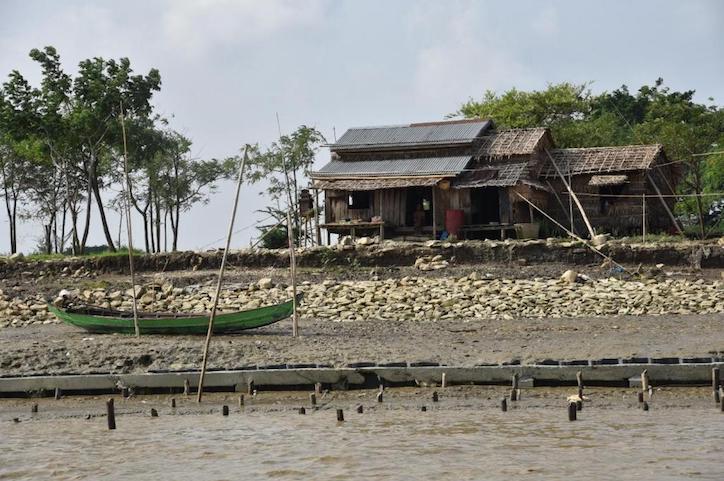 |
| Changes in river morphology including floods, erosion and landslides are affecting ecosystem habitats and the lives and livelihoods of communities living along Myanmar’s rivers. SERVIR-Mekong is using satellite-based monitoring tools to support Myanmar agencies and communities to manage the risks better. Credit: Rajesh Daniel / SEI |
In this way, SERVIR-Mekong has learned that Myanmar’s disaster management agency didn’t have access to accurate flood prediction data. And the Vietnamese government needed to be able to disseminate more detailed, but understandable, rainfall forecast information to its farmers. In both cases, SERVIR was able to develop custom tools based on NASA’s satellite information and is training the agency staff in their use. Vietnam has already started incorporating some of the new information into agricultural bulletins.
The Eastern and Southern Africa Hub has been working with the governments of Kenya and Tanzania to improve early drought warning capabilities. SERVIR’s needs assessment showed that in both countries, agencies didn’t have access to the data they needed to produce accurate maps of drought vulnerability. SERVIR and researchers at the University of California, Santa Barbara, a research partner, developed data sets together with government stakeholders and merged that data with existing estimates.
“We continually trained these stakeholders on data access, on analysis, on producing vulnerability information from these data sets,” says Macharia. “This was about three years of working with them. And eventually we produced the vulnerability maps that have been used now in Tanzania, especially, for water allocation and planning.”
As with any capacity building project, SERVIR’s successes have taken time to develop. “It takes time. We can’t expect that we just take the satellite data tool in, everybody uses it, they’re all happy, and everything works out well,” says Wadee Deeprawat, Senior Communications Specialist with SERVIR-Mekong. “Planning is really important from the start. You want to make sure you know who the players are. Getting buy-in from the governments and the stakeholders takes a lot of relationship building.”
Sirichaovanichkarn agrees that it has proven a challenge to achieve full buy-in and wide-scale use of the tools. “We think the way to fix this problem is to focus on user engagement and try to identify the people who can influence the process, the decision-makers.”
This challenge reiterates the importance of in-depth consultations from the beginning. Macharia says that dealing with high staff turnover rates in government agencies can be difficult, but talking with enough people will eventually lead to a solution. “It is critical to drill down to things that are very relevant,” he says. “If they see the benefits, there is a high probability they will use the tool.”
Ultimately, SERVIR is helping governments use the incredible science of NASA to improve the lives of everyone from farmers to city dwellers. “SERVIR’s science is not done in a black box. It’s really done to meet the needs of local people,” says Frankel-Reed. “And that to me is a truly significant change that’s come from SERVIR.”
-
SERVIR Service Planning in Action
This collection of case studies is a companion to the SERVIR Service Planning Toolkit. It provides concrete examples from SERVIR’s experience, and that of our partners, applying the Service Planning approach.
-
SERVIR Service Planning Toolkit
The Service Planning Toolkit is a resource for SERVIR Hubs and their partners to implement SERVIR's service planning approach.

