Articles & Stories
Dancing rivers of Myanmar – mapping moves from space
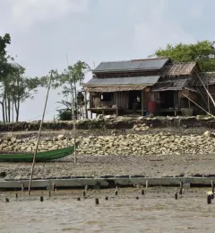
SERVIR-Mekong is using satellite-based monitoring tools to support Myanmar agencies to manage the risks of floods, erosion, and landslides are that are affecting those living along Myanmar's rivers.
| Karthikeyan Matheswaran, Thanapon Piman, and Rajesh Daniel | Stockholm Environment Institute