Articles & Stories Keeping a high-tech watch over green space 
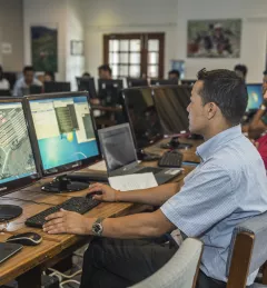
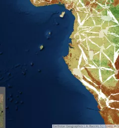
With state-of-the art satellite remote sensing techniques, countries can conduct accurate forest inventories as well as map and monitor land use change. March 3, 2017
Blog Tracking the changing landscape of Eastern and Southern Africa Countries need accurate land cover data and methods for national-level monitoring of land cover changes and forest loss to inform forest management and policy. February 7, 2017
Articles & Stories SERVIR tools supporting forest conservation in Mesoamerica Deforestation is a critical issue in Mesoamerica and the Caribbean. SERVIR has developed two online mapping and analysis tools to help policymakers in these regions conserve forests. October 31, 2016
Articles & Stories FAO and SERVIR Helping to keep Sharper Eye on Forests and Land Use around the world According to the World Wildlife Fund, over 2 billion people rely on forests for shelter, livelihoods, water, food, and fuel security. Forests even help renew our air supply, as they take in large amounts of carbon dioxide and release oxygen. September 30, 2016
Articles & Stories Story Map: SERVIR data supporting biological corridor and endangered gorilla species protection Deforestation and habitat fragmentation in the tropics represent major threats to biodiversity and contribute to carbon emissions. September 1, 2016