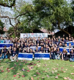
Articles & Stories Youth tackle air pollution using satellite data As Thailand's second largest city, Chiang Mai has been facing the problem of haze pollution over the past decade, due to agricultural practices and rapid industrial growth associated with tourism. April 9, 2020
Articles & Stories U.S. Government Convenes Innovators in Northern Thailand to Tackle Air Pollution Challenges A team of six youth innovators called ‚“No Grant SMOG” won the first prize at Smogathon Thailand 2020 for inventing active-learning tools to educate elementary school children about smog. February 21, 2020|Wadee Deeprawat, SERVIR-Mekong/ADPC
Articles & Stories Taking stock of the damage: Mapping the impact of the 2019 Bangladesh floods using satellite imagery In view of the recent flooding events in South Asia, ICIMOD has prepared flood inundation maps by analysing freely available satellite imagery. These maps provide a synoptic overview of the extent of the inundation caused by the floods and can aid disaster management agencies in prioritizing relief and rescue activities in flood-affected areas. August 10, 2019
Articles & Stories Mekong River Commission Utilizes Space Technology to Improve Flood Forecasting Lower Mekong countries suffer from the effects of seasonal flooding and flash flooding caused by monsoon rains and tropical storms. Regional and national level organizations and agencies require a range of information, forecasts, and decision-support tools to better prepare for, monitor, issue warnings, and respond to flood risk. August 8, 2019
Articles & Stories Dancing rivers of Myanmar – mapping moves from space Changes in river morphology including floods, erosion, and landslides are affecting ecosystem habitats and the lives and livelihoods of communities living along Myanmar's rivers. SERVIR-Mekong is using satellite-based monitoring tools to support Myanmar agencies and communities to manage the risks better. July 3, 2019