Articles & Stories
Geospatial technology in rice crop mapping: paving the way for enhanced food security in Nepal
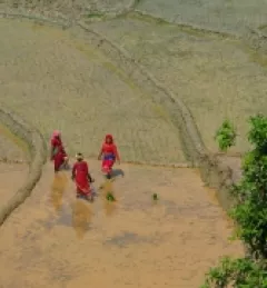
Over 60% of Nepal’s population works in agriculture. Much of this farming is in rice, a dietary staple in Nepali households. To support farming communities and food security, the government needs to know how much rice is being grown. This past year, Nepal’s Ministry of Agriculture and Livestock Development partnered with SERVIR to use innovative technology for a more accurate assessment of its rice area and production.
|Sravan Shrestha and Jaber Hassan, SERVIR Hindu Kush Himalaya