Strategy & Guidance USAID Geospatial Strategy USAID’s 2024-2028 Geospatial Strategy promotes leveraging the power of geospatial data and technology to target the delivery of international programs. November 15, 2023
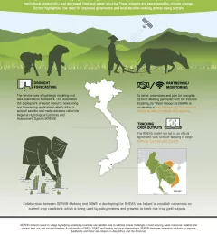
Fact Sheet Fact Sheet: Enhancing Drought Resilience in Vietnam SERVIR Mekong helped develop the Regional Hydrological Extremes and Assessment System (RHEAS), which automates the deployment of water resource nowcasting and forecasting applications to help mitigate the effects of drought in the lower Mekong region. January 13, 2021