Strategy & Guidance USAID Geospatial Strategy USAID’s 2024-2028 Geospatial Strategy promotes leveraging the power of geospatial data and technology to target the delivery of international programs. November 15, 2023
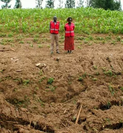
Use Case Use Case: Kenya Ministry of Agriculture, Livestock, Fisheries, and Cooperatives Learn how Kenya’s Ministry of Agriculture, Livestock, Fisheries, and Cooperatives (MoALFC) used the Regional Cropland Assessment and Monitoring Service to improve its yield assessment. November 23, 2021
Video Regional Drought Monitoring and Early Warning System SERVIR scientists discuss the how the Regional Drought Monitoring and Early Warning System is being used in the Hindu Kush Himalaya region. July 28, 2020
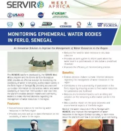
Infographic Fact Sheet: Monitoring Ephemeral Water Bodies Using Satellite Data to Guide Pastoralists to Water This fact sheet describes how SERVIR West Africa works with local stakeholders to strengthen the resilience of pastoral systems in Senegal. January 14, 2019