Strategy & Guidance USAID Geospatial Strategy USAID’s 2024-2028 Geospatial Strategy promotes leveraging the power of geospatial data and technology to target the delivery of international programs. November 15, 2023
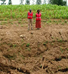
Use Case Use Case: Kenya Ministry of Agriculture, Livestock, Fisheries, and Cooperatives Learn how Kenya’s Ministry of Agriculture, Livestock, Fisheries, and Cooperatives (MoALFC) used the Regional Cropland Assessment and Monitoring Service to improve its yield assessment. November 23, 2021
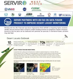
Fact Sheet Fact Sheet: Desert Locust Monitoring SERVIR partners with UN FAO on data fusion product to improve desert locust monitoring This fact sheet highlights how SERVIR is using satellite data to pinpoint breeding locations for locusts so that the pests can be eradicated before they take flight. February 1, 2021
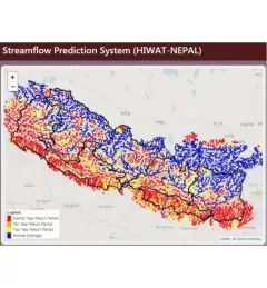
Use Case Use Case: Nepal Department of Hydrology and Meteorology The Nepal DHM is the national agency responsible for monitoring and managing the hydrological resources of Nepal. This Use Case describes how they used the SERVIR Enhancing Flood Early Warning Services (EWS). September 16, 2020
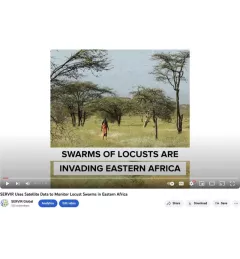
Video Video: Using Satellite Data to Monitor Locust Swarms in Eastern Africa SERVIR Global is using NASA satellites to guide USAID and FAO resources on the ground to fight locusts in east Africa. August 14, 2020