Infographic
Using Satellite Imagery to Expand Crop Insurance in Kenya
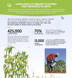
Through a partnership between SERVIR Eastern & Southern Africa and the Kenya Ministry of Agriculture, a new satellite-based crop mapping system and sampling methodology was developed to streaml