Tool
SERVIR Service Planning Toolkit
The Service Planning Toolkit is a resource for SERVIR Hubs and their partners to implement SERVIR's service planning approach.

32 results
The Service Planning Toolkit is a resource for SERVIR Hubs and their partners to implement SERVIR's service planning approach.
Collect Earth Online is a custom built, open-source, satellite image viewing and interpretation system developed by SERVIR, FAO, and other partners as a tool for use in projects that require land cover and/or land use data.
SERVIR project director Dan Irwin has just returned from the United Nations Framework Convention on Climate Change 20th Conference of Parties (COP20) held in Lima, Peru.
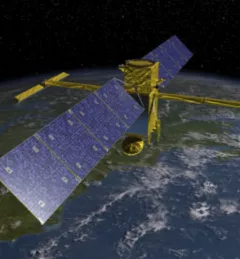
In the near future, NASA and CNES, the French space agency, will debut a new satellite that many researchers believe could be a game changer in understanding and managing Earth's greatest resource: water.
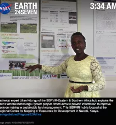
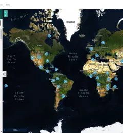
SERVIR is truly an "Earth247" operation around the globe.
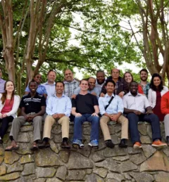
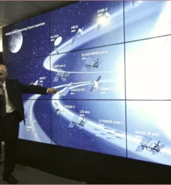
Team members of the NASA/USAID SERVIR program converged in Huntsville, Alabama, for a special workshop 18-22 April 2016.
Through SERVIR, NASA's Earth Science Division's Applied Sciences Program advances the use of space-based observations to inform policy and decision makers as they adapt to the impacts of global change and plan for a sustainable future.
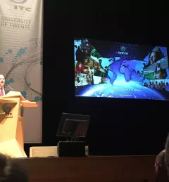
On September 22, 2016, SERVIR NASA Global Program Manager Dan Irwin delivered the prestigious Schermerhorn Lecture at the Opening of the Academic Year 2016-2017 of the University of Twente, Faculty of Geo-Information Science and Earth Observation.
According to the World Wildlife Fund, over 2 billion people rely on forests for shelter, livelihoods, water, food, and fuel security. Forests even help renew our air supply, as they take in large amounts of carbon dioxide and release oxygen.
On December 14, 2016, NASA Marshall Space Flight Center's Dan Irwin received the Rotary Humanitarian STAR Award.