Video
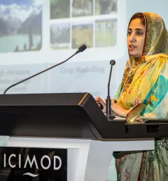
Regional Drought Monitoring and Early Warning System

SERVIR scientists discuss the how the Regional Drought Monitoring and Early Warning System is being used in the Hindu Kush Himalaya region.

18 results
SERVIR scientists discuss the how the Regional Drought Monitoring and Early Warning System is being used in the Hindu Kush Himalaya region.
SERVIR Hindu Kush Himalaya helps improve environmental management and resilience in critical areas like food security, water resources management, disaster resilience, and sustainable lan
The Monitoring Extreme Weather in the Hindu Kush Himalaya (HKH) service provides a customized numerical weather prediction toolkit to assess high impact convective weather events over the HKH region.
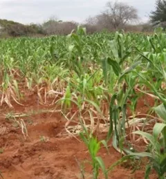
The Regional Cropland Assessment and Monitoring Service seeks to provide timely information for food security assessments through the development of national and regional crop monitors in East Africa.
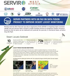
This fact sheet highlights how SERVIR is using satellite data to pinpoint breeding locations for locusts so that the pests can be eradicated before they take flight.

Meet Finu Shrestha, GIS Research Associate for ICIMOD/SERVIR-Hindu Kush Himalaya.
SERVIR West Africa promotes the use of publicly available satellite imagery and related geospatial tools and products to help key stakeholders and decision makers in the region make more informed d
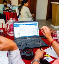
ICIMOD, under its SERVIR-Hindu Kush Himalaya (SERVIR-HKH) and Climate Services for Resilient Development (CSRD) Initiatives, is collaborating with technical organizations in the United States and meteorological and agricultural institutions in the HKH to establish a regional agricultural drought monitoring and early warning system.
The Hindu Kush Himalayan (HKH) region is no stranger to water- and weather-induced hazards. Every year, these disasters result in loss of lives, livelihoods, and damage to infrastructure throughout HKH countries.
The SERVIR program, launched in 2005, connects NASA, U.S. researchers, a network of development partners around the world, and companies like Google to harness the power of satellite observations — helping countries see, with greater clarity, how their environments affect well-being and safety.