
Weather & Climate Resilience
Flood Monitoring in Specific Basins in Colombia
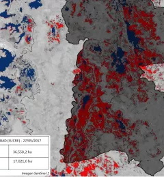
This flood monitoring service utilizes Google Earth Engine and the available LandSAT and SENTINEL data collections, spanning from 2014 to the present date, to determine water surface areas within specific date ranges.