Articles & Stories
SERVIR-Mekong adds key tools for environmental monitoring
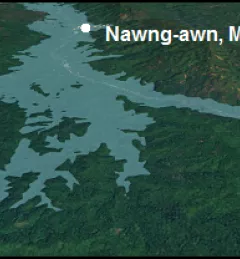
Recently, the SERVIR-Mekong team added three new tools to aid in the environmental monitoring of the Mekong River Basin.

5 results
Recently, the SERVIR-Mekong team added three new tools to aid in the environmental monitoring of the Mekong River Basin.

Landscapes on Earth are changing at unprecedented levels. For scientists, practitioners and environmental decision makers, tracking these changes efficiently and accurately is critical to protecting lives and livelihoods.
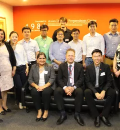
During 1-2 June 2017, SERVIR-Mekong personnel led a kick-off workshop for seven grantee organizations selected under the SERVIR-Mekong Grants Program at the Asian Disaster Preparedness Center in Bangkok, Thailand. The purpose of the event was to define roles and responsibilities, outline grant activities, and provide opportunities for the grantees to interact in person with SERVIR-Mekong staff.

The United States Agency for International Development (USAID) and the U.S. National Aeronautics and Space Administration (NASA) announced on March 8 a five-year project that will use satellite imagery to address environment and development challenges across the Amazon Basin.
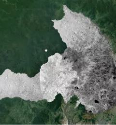
The Mapping with Radar in Imbabura service brings Synthetic Aperture Radar (SAR) and other remote sensing resources to map land cover of the province of Imbabura in Ecuador.