Articles & Stories
Himalayan Storm Watchers Save Lives
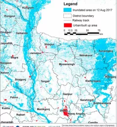
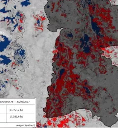
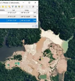
A recent Esri blog features advances made by ICIMOD towards improved disaster management, early warning and response in the Hindu Kush Himalaya region.