Articles & Stories
Applied Sciences Team project informs decision makers with fire season forecast
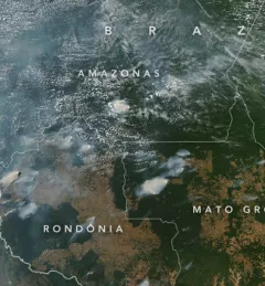
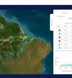
SERVIR AST member Doug Morton discusses the upcoming fire season in Amazonia in a new NASA article.

29 results
SERVIR AST member Doug Morton discusses the upcoming fire season in Amazonia in a new NASA article.
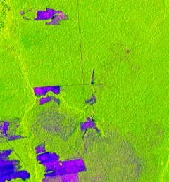
One of the major challenges in monitoring forests is identifying forest degradation processes. Recent years have seen advancements in satellite remote sensing technology, which has in turn revealed changed patterns of illegal deforestation activity in the Amazon rainforest.
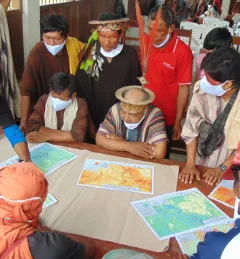
In line with its service co-development approach, SERVIR-Amazonia is bringing diverse Brazilian stakeholders together to identify local development problems and identify solutions in form of tools, data sets, training resources and capacity building activities that use satellite data, Earth science, and geospatial technologies.
Quantifying the Effects of Forest Changes on Provisioning and Regulating Ecosystem Services is a service that allows stakeholders to better understand the tradeoffs between development activities and ecosystem services.
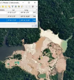
Monitoring of gold mining in the Brazilian Amazon is a service that aims to produce near real-time information on mining deforestation and activity in the Tapajos basin, State of Para.
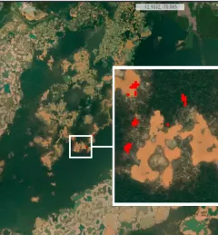
The Monitoring of Gold Mining in the Peruvian Amazon service produces near real-time information on deforestation and mining activity in the southern Peruvian Amazon.
The Monitoring Forest Dynamics to Enable Biodiversity Conservation in the Amazon service - now completed - helped introduce "TerraBio," a monitoring tool to assess the impact of private sector engagement on biodiversity conservation in the Amazon.
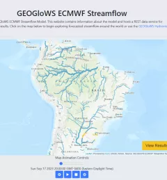
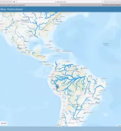
The Improving Resilience and Reducing Risk of Extreme Hydrological Events service provides stakeholders in the Amazon Basin region with improved historical water information and a flood forecasting ability to support greater resiliency to flood disasters.
The Forecasting Seasonal to Sub-seasonal Fire and Agricultural Risk from Drought service provides information for evaluating drought conditions at temporal and spatial resolution to predict fire vulnerability in the Amazon basin.