Articles & Stories
SERVIR Profile of Trilochana Basnett

Meet Trilochana Basnett, intern for ICIMOD/SERVIR-Hindu Kush Himalaya.

20 results
Meet Trilochana Basnett, intern for ICIMOD/SERVIR-Hindu Kush Himalaya.

The United States Agency for International Development (USAID) and the U.S. National Aeronautics and Space Administration (NASA) announced on March 8 a five-year project that will use satellite imagery to address environment and development challenges across the Amazon Basin.
A blog posted by Spatial Informatics Group (SIG) describes ways that the new SERVIR-Amazonia hub will bring geospatial information to assist with sustainable development problems and natural resource protection for the Amazonia region.
This flood monitoring service utilizes Google Earth Engine and the available LandSAT and SENTINEL data collections, spanning from 2014 to the present date, to determine water surface areas within specific date ranges.
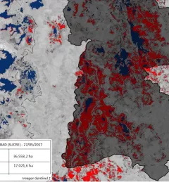
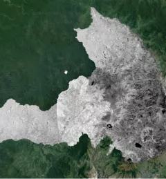
One of the major challenges in monitoring forests is identifying forest degradation processes. Recent years have seen advancements in satellite remote sensing technology, which has in turn revealed changed patterns of illegal deforestation activity in the Amazon rainforest.
The Map Validation with Collect Earth Online (CEO) service enables more accurate forest monitoring data, which is necessary for the evaluation of public policy related to forest management.
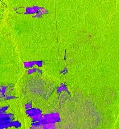
The Mapping with Radar in Imbabura service brings Synthetic Aperture Radar (SAR) and other remote sensing resources to map land cover of the province of Imbabura in Ecuador.
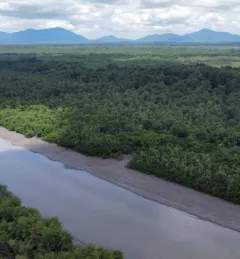
The Spatio-temporal monitoring of the mangrove ecosystem, in collaboration with the CIIFEN, generated a Google Earth Engine code to support the monitoring of mangrove change.

The Spatio-temporal monitoring of soil water erosion service, in collaboration with the Ecuadorian Ministry of Agriculture and Livestock (MAG), will generate a Google Earth Engine app to support the monitoring of soil water erosion and the analysis of its impact in the Ecuadorian Amazon basin.
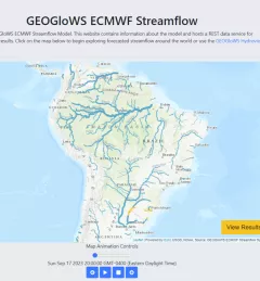
The Improving Resilience and Reducing Risk of Extreme Hydrological Events service provides stakeholders in the Amazon Basin region with improved historical water information and a flood forecasting ability to support greater resiliency to flood disasters.