Video
Regional Drought Monitoring and Early Warning System

SERVIR scientists discuss the how the Regional Drought Monitoring and Early Warning System is being used in the Hindu Kush Himalaya region.

84 results
SERVIR scientists discuss the how the Regional Drought Monitoring and Early Warning System is being used in the Hindu Kush Himalaya region.

From a modest upbringing in a plaster-coated, mud-and-bamboo house in Kampala, Uganda to sharing the million dollar Al Sumait Prize for African Development, Assistant Professor Catherine Nakalembe’s life could easily become a Hollywood movie.
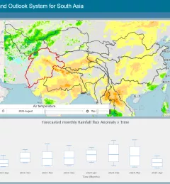
The Regional Drought Monitoring and Outlook System (RDMOS) was developed to help predict, mitigate, and adequately respond to drought vulnerabilities in the HKH region.
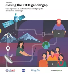
Between 2018 and 2021, SERVIR HKH trained 410 women in “Empowering women in GIT” to bridge the technology and gender gap in the region. Some of the key outcomes of these trainings are summarized in this report.
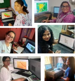
Since 2018, SERVIR has conducted 12 training programs for young and early-career women in geospatial information technology (GIT), reaching 1,490 women across the region. The training focuses on using technologies to collect, store, analyze, and visualize spatial or geographic data about observing the Earth’s surface and human activity. Participants learn about key concepts and how to use applications that depend on EO data and GIT.
|Jaber Hassan and Poonam Tripathi, SERVIR HKH

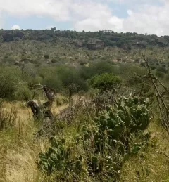
Women play a pivotal role in agricultural production. Worldwide, women represent 43 percent of the agricultural labor force; in Kenya, that number is between 42 and 65 percent.
|Janet Nackoney, Land and Resource Governance Officer, USAID and Dorah Nesoba, Public Relations and Communication Officer, RCMRD
Enhancing Flood Early Warning Services aims to build the resilience of vulnerable communities in the Hindu Kush Himalayan region by increasing flood forecast lead times that are hosted on an interactive web platform.
SERVIR Hindu Kush Himalaya helps improve environmental management and resilience in critical areas like food security, water resources management, disaster resilience, and sustainable lan
The Ecological Modeling Service uses select data sources, derived products, and modeling techniques to better understand the distribution and spread of invasive species.
From 2008 - 2023, SERVIR Eastern and Southern Africa developed a diverse collection of user-tailored geospatial services that use Earth observations and NASA data to inform resilient development in