Video
Video: SERVIR Motion Graphic
Learn how the SERVIR program is harnessing the power of science and technology for development in this two minute video narrated by NASA Astronaut Mae Jemison.

81 results
Learn how the SERVIR program is harnessing the power of science and technology for development in this two minute video narrated by NASA Astronaut Mae Jemison.
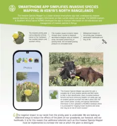
The Invasive Species Mapper is a citizen-science smartphone app that crowdsources invasive species detection to give managers information on their current extent and spread.
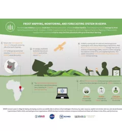
The Kenya tea industry supports 10 percent of Kenya's population, around 3 million families. The industry is prone to damage by frost due to the altitudes in which it is grown.

SERIR uses a "service" approach to identifying and addressing climate challenges.
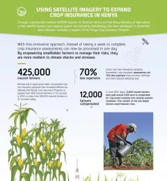
Through a partnership between SERVIR Eastern & Southern Africa and the Kenya Ministry of Agriculture, a new satellite-based crop mapping system and sampling methodology was developed to streaml
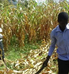
Kenya’s Ministry of Agriculture is collaborating with USAID and NASA to use satellite tools that expand their understanding of the climate-related challenges that farmers are facing.
|Lena Pransky and Jacob Ramthun, NASA Science Coordination Office
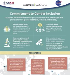
Learn more about how the SERVIR network works to make geospatial information technologies and professions more gender responsive and inclusive.
The U.S. Forest Service is hosting webinars to introduce an online training course on Remote Sensing for Forest Cover Change Detection. This activity comes as part of the USAID-funded SilvaCarbon initiative.

From a modest upbringing in a plaster-coated, mud-and-bamboo house in Kampala, Uganda to sharing the million dollar Al Sumait Prize for African Development, Assistant Professor Catherine Nakalembe’s life could easily become a Hollywood movie.