Strategy & Guidance
USAID Geospatial Strategy

USAID’s 2024-2028 Geospatial Strategy promotes leveraging the power of geospatial data and technology to target the delivery of international programs.

164 results
USAID’s 2024-2028 Geospatial Strategy promotes leveraging the power of geospatial data and technology to target the delivery of international programs.
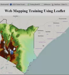
The Web has changed every aspect of our lives, from daily events to professional undertakings such as work related activities. Geographic Information Systems (GIS) – tools that enable us to manipulate the geographic aspects of data – have also been affected by web technology.
|Patrick Kabatha, RCMRD/SERVIR
This guide was developed to accompany the materials provided for the SERVIR AST funded project, "Forest carbon assessment for REDD+ in East Africa SERVIR region."
These training materials provide an introduction to the Ensemble Framework for Flash Flood Forecasting (EF5) system developed by the SERVIR Applied Sciences Team.
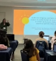
In Costa Rica, the GeoFem workshops create a supportive environment for women to combine their unique knowledge and experiences with Earth science technology. The following stories demonstrate how everyone benefits when women are empowered to use Earth science in community decision-making.
|Lena Pransky, NASA Science Coordination Office
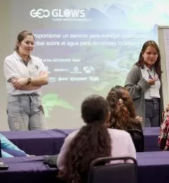
Because climate change disproportionately impacts women and girls, Earth science cannot be fully effective in addressing climate issues without including the realities and unique knowledge of women. Unfortunately, many women are excluded from participating in both the field of Earth science and in community decision-making.
|Lena Pransky, NASA Science Coordination Office
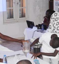
SERVIR West Africa created youth clubs to provide an inclusive space where all students, especially girls, can explore and gain skills in Science, Technology, Engineering, and Mathematics (STEM) and gain exposure to environmental monitoring tools such as geographic information systems, remote sensing, and other digital technologies.
|Thioro Codou Niang, SERVIR West Africa and Lena Pransky, Science Coordination Office
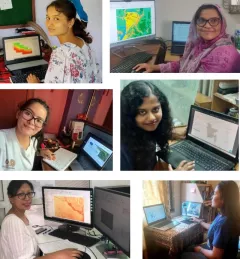
Since 2018, SERVIR has conducted 12 training programs for young and early-career women in geospatial information technology (GIT), reaching 1,490 women across the region. The training focuses on using technologies to collect, store, analyze, and visualize spatial or geographic data about observing the Earth’s surface and human activity. Participants learn about key concepts and how to use applications that depend on EO data and GIT.
|Jaber Hassan and Poonam Tripathi, SERVIR HKH
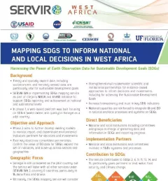
This fact sheet highlights the service, Building a Platform to Track Progress on SDGs and Inform Decisions in Senegal.
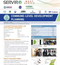
This fact sheet highlights how SERVIR West Africa is supporting sustainable management in Burkina Faso through commune-level development planning.