Video
Regional Drought Monitoring and Early Warning System

SERVIR scientists discuss the how the Regional Drought Monitoring and Early Warning System is being used in the Hindu Kush Himalaya region.

119 results
SERVIR scientists discuss the how the Regional Drought Monitoring and Early Warning System is being used in the Hindu Kush Himalaya region.

The Monitoring Forest Dynamics to Enable Biodiversity Conservation in the Amazon service - now completed - helped introduce "TerraBio," a monitoring tool to assess the impact of private sector engagement on biodiversity conservation in the Amazon.
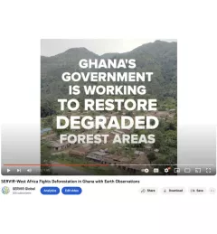
Ghana is home to some of the most biodiverse and carbon-dense forests in the world. But more than a third of them have been lost in recent decades.
The U.S. Forest Service is hosting webinars to introduce an online training course on Remote Sensing for Forest Cover Change Detection. This activity comes as part of the USAID-funded SilvaCarbon initiative.
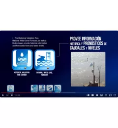
This video provides an overview of the GEOGloWS tool in Ecuador in English and Spanish. GEOGloWS are web applications for monitoring and forecasting hydrometeorological events using global models, satellite information, and observed data.
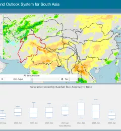
The Regional Drought Monitoring and Outlook System (RDMOS) was developed to help predict, mitigate, and adequately respond to drought vulnerabilities in the HKH region.

Mangrove forests do a lot of heavy lifting to mitigate the effects of coastal flooding. As NASA turns the spotlight on oceans this Earth Day, learn how the joint NASA-USAID SERVIR program is using Earth satellites to support these unique ecosystems that protect 15% of the world’s coasts.
|Stephanie A. Jiménez, Christine Evans, Vanesa Martín, Jacob Ramthun
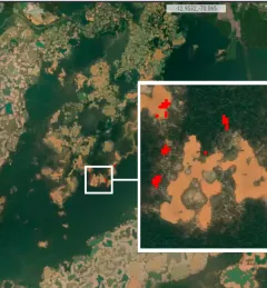
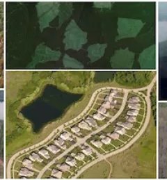
The Monitoring of Gold Mining in the Peruvian Amazon service produces near real-time information on deforestation and mining activity in the southern Peruvian Amazon.
Enhancing Flood Early Warning Services aims to build the resilience of vulnerable communities in the Hindu Kush Himalayan region by increasing flood forecast lead times that are hosted on an interactive web platform.
The Ecological Modeling Service uses select data sources, derived products, and modeling techniques to better understand the distribution and spread of invasive species.