Fact Sheet
SERVIR & SilvaCarbon
Partnering for natural climate solutions
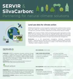
SilvaCarbon is an important collaborator with SERVIR.

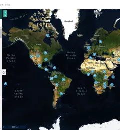
12 results
SilvaCarbon is an important collaborator with SERVIR.
The Monitoring Forest Dynamics to Enable Biodiversity Conservation in the Amazon service - now completed - helped introduce "TerraBio," a monitoring tool to assess the impact of private sector engagement on biodiversity conservation in the Amazon.
Collect Earth Online is a custom built, open-source, satellite image viewing and interpretation system developed by SERVIR, FAO, and other partners as a tool for use in projects that require land cover and/or land use data.
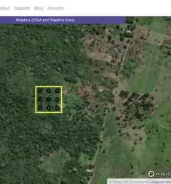
The Map Validation with Collect Earth Online (CEO) service enables more accurate forest monitoring data, which is necessary for the evaluation of public policy related to forest management.
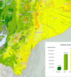
The Mapping Soil Fertility in Ecuador service, in collaboration with the Ecuadorian Ministry of Agriculture, generated high-resolution (30 m) digital soil maps of key nutrients for agricultural development.
The Monitoring and Evaluation of Mangroves in Guyana service brings Synthetic Aperture Radar (SAR) and other remote sensing resources to map the extent and structure of mangrove forests along the coast of Guyana.
Quantifying the Effects of Forest Changes on Provisioning and Regulating Ecosystem Services is a service that allows stakeholders to better understand the tradeoffs between development activities and ecosystem services.
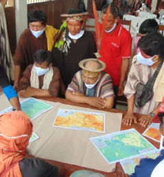
This collection of case studies is a companion to the SERVIR Service Planning Toolkit. It provides concrete examples from SERVIR’s experience, and that of our partners, applying the Service Planning approach.
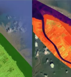
The Mapping with Radar in Imbabura service brings Synthetic Aperture Radar (SAR) and other remote sensing resources to map land cover of the province of Imbabura in Ecuador.

The Spatio-temporal monitoring of the mangrove ecosystem, in collaboration with the CIIFEN, generated a Google Earth Engine code to support the monitoring of mangrove change.