Strategy & Guidance
USAID Geospatial Strategy

USAID’s 2024-2028 Geospatial Strategy promotes leveraging the power of geospatial data and technology to target the delivery of international programs.

118 results
USAID’s 2024-2028 Geospatial Strategy promotes leveraging the power of geospatial data and technology to target the delivery of international programs.
These training materials provide an introduction to the Ensemble Framework for Flash Flood Forecasting (EF5) system developed by the SERVIR Applied Sciences Team.

SERVIR will be at the American Geophysical Union (AGU) fall conference December 11 - 15, 2023. We have compiled a list of SERVIR affiliated colleagues who will be presenting throughout the week. Please come and meet us at our talks and posters.
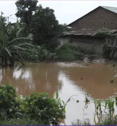
Enhancing Flood Early Warning Services aims to build the resilience of vulnerable communities in the Hindu Kush Himalayan region by increasing flood forecast lead times that are hosted on an interactive web platform.
As part of this service, SERVIR HKH, with the technical support of Brigham Young University developed a streamflow prediction tool that incorporates all primary and secondary rivers in the HKH region
The Development and Management of Groundwater Analysis and Information System in Niger is a platform to improve and make available information on groundwater in Maradi and Zinder.
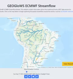
The Improving Resilience and Reducing Risk of Extreme Hydrological Events service provides stakeholders in the Amazon Basin region with improved historical water information and a flood forecasting ability to support greater resiliency to flood disasters.
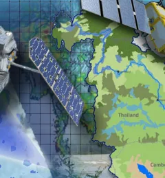
Through the Improving the Mekong River Commission's (MRC) Regional Flood Forecasting Service, SERVIR Mekong supported the MRC to use new-generation satellite-derived precipitation products to increase flood forecast accuracy.
The Mitigating Impacts and Increasing Benefits from Changing River Courses in Myanmar service supported national agencies in monitoring changing river courses and planning riverbank protection measures to mitigate localized impacts to infrastructure.

The Monitoring Ephemeral Water Bodies in Ferlo, Senegal Service is a web-based platform for assessing water availability in all known ponds, thus facilitating water management in arid areas such as the Ferlo Region of Senegal.