Strategy & Guidance
USAID Geospatial Strategy

USAID’s 2024-2028 Geospatial Strategy promotes leveraging the power of geospatial data and technology to target the delivery of international programs.

6 results
USAID’s 2024-2028 Geospatial Strategy promotes leveraging the power of geospatial data and technology to target the delivery of international programs.
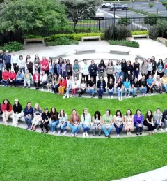
The GeoFem: Women in Geospatial Technologies workshop was hosted and organized by the Inter-American Institute for Cooperation on Agriculture (IICA) and the Central America Aerospace Network (RAC) in San José.
|Lena Pransky, NASA Science Coordination Office

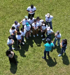
NASA astronaut Colonel Frank Rubio met with more than 200 young students at the Gerardo Barrios University in San Miguel, El Salvador. In 2017, Rubio made history as the first astronaut of Salvadoran descent selected by NASA, and again in 2022 when he launched on his first spaceflight.
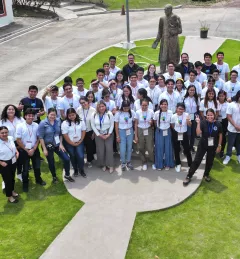
SERVIR recently collaborated with the Central American Aerospace Network to lead the Jóvenes Geoespaciales (“Geospatial Youth”) workshop for 45 young students in San Miguel, El Salvador. The students used NASA Earth data and open access tools to create their own projects for local climate resilience, including maps for monitoring crop health, wildfires, and deforestation.
|Lena Pransky, NASA Science Coordination Office

Youth are not only the climate leaders of tomorrow, but their perspectives and innovations are necessary to address climate issues today.
|Lena Pransky and Jacob Ramthun, NASA Science Coordination Office
At the Jóvenes Geoespaciales training in El Salvador, 45 talented young students worked in groups to use NASA satellite data and Google Earth Engine to develop projects for local climate resilience. Each group learned how to develop their own ArcGIS StoryMaps web page for displaying their data, which they can use to advocate for climate action.
|Lena Pransky, NASA Science Coordination Office