Strategy & Guidance
USAID Geospatial Strategy

USAID’s 2024-2028 Geospatial Strategy promotes leveraging the power of geospatial data and technology to target the delivery of international programs.

8 results
USAID’s 2024-2028 Geospatial Strategy promotes leveraging the power of geospatial data and technology to target the delivery of international programs.

SERVIR will be at the American Geophysical Union (AGU) fall conference December 11 - 15, 2023. We have compiled a list of SERVIR affiliated colleagues who will be presenting throughout the week. Please come and meet us at our talks and posters.
As COP28 draws to a close in Dubai, the SERVIR program, implemented by NASA, USAID, and key regional partners, is reflecting on its role in addressing the climate crisis. This story describes are four ways SERVIR is contributing to international climate action for both climate mitigation and adaptation.
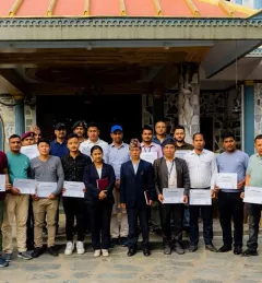
As part of this service, SERVIR HKH, with the technical support of Brigham Young University developed a streamflow prediction tool that incorporates all primary and secondary rivers in the HKH region
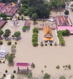
The Supporting Better Riverine and Flash Flood Forecasting for the Lower Mekong service improves riverine flood forecasts and enhances flash flood guidance monitoring in the region.
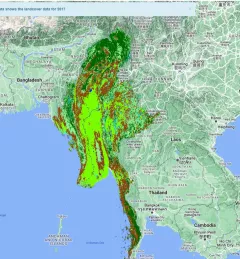
The Supporting Climate Adaptation and Mitigation in Myanmar service was a collaboration between SERVIR and Myanmar develop a National Land Cover Monitoring System, a web-based tool created using the cloud-based Google Earth Engine.
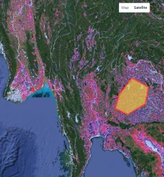
Through the Supporting Flood Emergency Preparedness for Myanmar Service, SERVIR Mekong co-developed and supported the use of a systematic decision-support tool for the Myanmar Department of Disaster Management to identify areas with high flood risk.
For Earth Day this year, SERVIR is voicing its commitment to addressing climate change in its services. Climate change threatens sources of food and water, increase the severity and frequency of disasters, endanger critical ecosystems, and can exacerbate existing social inequities.