Strategy & Guidance
USAID Geospatial Strategy

USAID’s 2024-2028 Geospatial Strategy promotes leveraging the power of geospatial data and technology to target the delivery of international programs.

5 results
USAID’s 2024-2028 Geospatial Strategy promotes leveraging the power of geospatial data and technology to target the delivery of international programs.

SERVIR will be at the American Geophysical Union (AGU) fall conference December 11 - 15, 2023. We have compiled a list of SERVIR affiliated colleagues who will be presenting throughout the week. Please come and meet us at our talks and posters.
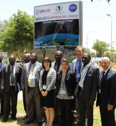
On July 14, 2016, NASA and the U.S. Agency for International Development (USAID) launched SERVIR-West Africa, a joint project to strengthen environmental monitoring in West Africa.

Issaka Lona, Hydrology and Water-Related Natural Disasters / Weather and Climate for Food Security and Natural Resource Management Thematic Lead for AGRHYMET / SERVIR-West Africa, is profiled.
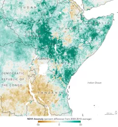
A single desert locust can consume its body weight in vegetation in one day. When 40 million of them gather, they can devour as much food as 35,000 people.