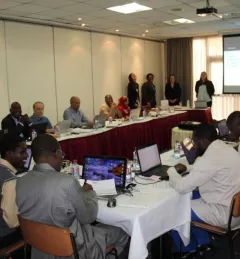
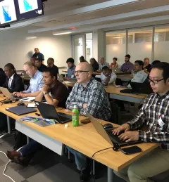
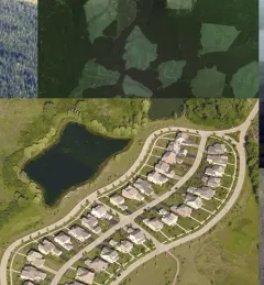
Google Earth Engine 'roadshow' continues in Myanmar
Read about how a partnership between SERVIR and Google continues to bring the power of Google Earth Engine (GEE) to the lower Mekong through trainings across the region.
123 results
Read about how a partnership between SERVIR and Google continues to bring the power of Google Earth Engine (GEE) to the lower Mekong through trainings across the region.
The SERVIR Science Coordination Office recently convened a week-long Geospatial Information Technology (GIT) exchange hosted at the University of San Francisco for members of the SERVIR global network.
In the context of the U.S. Agency for International Development (USAID)-funded SilvaCarbon initiative, the US Forest Service (USFS) will be hosting a webinar to introduce an online training course on Remote Sensing for Forest Cover Change Detection using freely available, open source software (QGIS and Google Earth Engine).
The SERVIR global network recently convened a four-day Service Planning Exchange hosted at the Regional Center for Mapping of Resources for Development (RCMRD) -- SERVIR’s Eastern & Southern Africa Hub.
SERVIR hubs joined over 185 other locations in 69 countries across the globe in hosting the 2017 NASA International Space Apps Challenge.
Thirty-eight participants—13 of them women—from Nepal and Kenya, convened for a four-day training workshop in Kathmandu, Nepal, on the Google Earth Engine (GEE) platform.
Begum Rushi from the SERVIR Science Coordination Office and Pradeep Dangal from the International Centre for Integrated Mountain Development (ICIMOD)/SERVIR-Hindu Kush Himalaya led a training on the Variable Infiltration Capacity (VIC) hydrological model at ICIMOD in Kathmandu, Nepal, 21 - 23 May 2017.
During 1-2 June 2017, SERVIR-Mekong personnel led a kick-off workshop for seven grantee organizations selected under the SERVIR-Mekong Grants Program at the Asian Disaster Preparedness Center in Bangkok, Thailand. The purpose of the event was to define roles and responsibilities, outline grant activities, and provide opportunities for the grantees to interact in person with SERVIR-Mekong staff.
SERVIR-Eastern and Southern Africa (E&SA) at the Regional Centre for Mapping of Resources for Development (RCMRD), together with the government of Rwanda, recently released new 2015 land cover maps, disseminating them during a workshop in May 2017 in Kigali.
How does one leverage the latest scientific and technological advances to place the power of the Cloud and Earth observations (EO) at the fingertips of researchers based in dynamically changing countries?