Agriculture & Food Security
Locust Monitoring
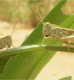
The primary objective of the P-Locust service is to enhance the monitoring and prevention efforts against locust population growth.

21 results
The primary objective of the P-Locust service is to enhance the monitoring and prevention efforts against locust population growth.
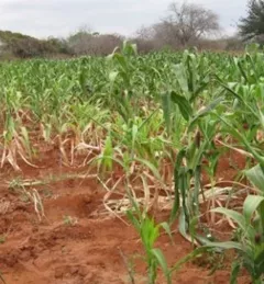
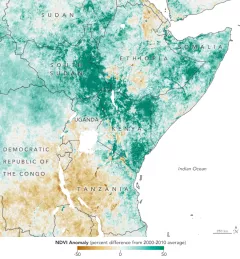
The Regional Cropland Assessment and Monitoring Service seeks to provide timely information for food security assessments through the development of national and regional crop monitors in East Africa.
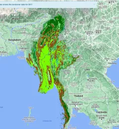
The Supporting Climate Adaptation and Mitigation in Myanmar service was a collaboration between SERVIR and Myanmar develop a National Land Cover Monitoring System, a web-based tool created using the cloud-based Google Earth Engine.
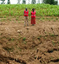
Learn how Kenya’s Ministry of Agriculture, Livestock, Fisheries, and Cooperatives (MoALFC) used the Regional Cropland Assessment and Monitoring Service to improve its yield assessment.
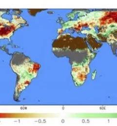
The Evaporative Stress Index (ESI) dataset reveals the regions of drought where vegetation is stressed due to lack of water, enabling agriculture ministries to provide actionable advice to farmers about irrigation.
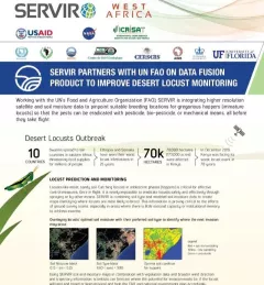
This fact sheet highlights how SERVIR is using satellite data to pinpoint breeding locations for locusts so that the pests can be eradicated before they take flight.
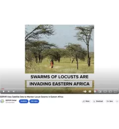
SERVIR Global is using NASA satellites to guide USAID and FAO resources on the ground to fight locusts in east Africa.
The ability to transform data into actionable information and obtain easily accessible, analysis-ready Earth observation (EO) data is often a critical missing link for decision makers in the developing world.
A single desert locust can consume its body weight in vegetation in one day. When 40 million of them gather, they can devour as much food as 35,000 people.
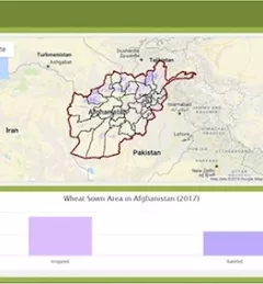
Wheat is one of Afghanistan's largest agricultural products, yet current production levels fail to meet increasing demand, and wheat remains one of the nation's biggest imports.
|Megan Kirchner, Communications Intern for the NASA SERVIR Science Coordination Office