Tool
SERVIR Service Planning Toolkit
The Service Planning Toolkit is a resource for SERVIR Hubs and their partners to implement SERVIR's service planning approach.

124 results
The Service Planning Toolkit is a resource for SERVIR Hubs and their partners to implement SERVIR's service planning approach.
The service, Building a Dashboard to Monitor, Evaluate and Report Landscape Improvements in Cambodia, addresses the demand from USAID/Cambodia to monitor and evaluate projects that target biophysical improvement and enhance biodiversity conservation on the ground.
The Increased Capacity and Public Access to the Ministry of Environment (MOE) Geospatial Data Portal service supported the Cambodia MOE’s sustainable landscape initiatives by increasing public access to its Environmental Data Portal.
The service, Increased Capacity of NGOs and Educational Institutions to use Remote Sensing to Monitor Forest Cover and Landscape Management, increased technical capacity and provided technical assistance to select partners working to monitor and protect land and forest resources in Cambodia.
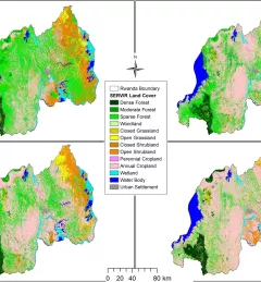
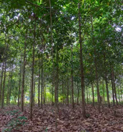
The Land Use Land Cover and Change Mapping Service was designed to provide governments with data, tools, and skills to better understand relevant intervention actions related to land conservation and management, ensuring that land resources can be efficiently monitored and regulated.
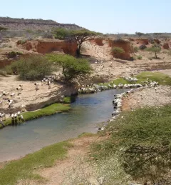
The Rangeland Assessment and Monitoring Service facilitates the near real-time assessment and monitoring of rangeland resources by developing a web-based tool to aggregate key indicators of rangeland productivity.
The Satellite-Based Water Quality Monitoring Service leverages Earth observing satellite information to assess historical water quality changes of in-land trans-boundary lakes.
The Support for Commune-Level Development Planning in Burkina Faso service is developing an information platform for monitoring of the physical occupation, land use, land cover, and spatial data infrastructure of commune-level administrative areas in Burkina Faso to support decision making related to sustainable management.
Forty students from major cities and the mountains of Pakistan assembled for a special event in Islamabad, Pakistan, 24-27 November 2014, to learn about the environmental impacts of climate change and about state of the art tools for addressing this issue.
Across the globe, disasters and their impacts have been on the rise. Developing countries are especially vulnerable to risks from natural hazards such as floods, landslides, and droughts. SERVIR-Eastern and Southern Africa is helping such countries in their region leverage geospatial technologies to reduce disaster risk and enhance regional capacity in disaster management.