Agriculture & Food Security
Regional Drought Monitoring and Outlook System for South Asia
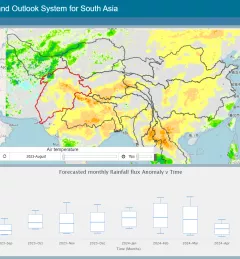
The Regional Drought Monitoring and Outlook System (RDMOS) was developed to help predict, mitigate, and adequately respond to drought vulnerabilities in the HKH region.