Articles & Stories
Landscape and Ecosystems Thematic Lead Interview -- Issifou Alfari

Issifou Alfari, Co-Chief of Party for AGRHYMET / SERVIR-West Africa, is profiled.

62 results
Issifou Alfari, Co-Chief of Party for AGRHYMET / SERVIR-West Africa, is profiled.
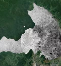
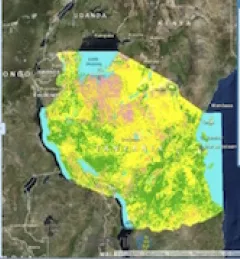
The Mapping with Radar in Imbabura service brings Synthetic Aperture Radar (SAR) and other remote sensing resources to map land cover of the province of Imbabura in Ecuador.
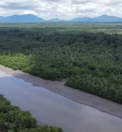
The Spatio-temporal monitoring of the mangrove ecosystem, in collaboration with the CIIFEN, generated a Google Earth Engine code to support the monitoring of mangrove change.

The Spatio-temporal monitoring of soil water erosion service, in collaboration with the Ecuadorian Ministry of Agriculture and Livestock (MAG), will generate a Google Earth Engine app to support the monitoring of soil water erosion and the analysis of its impact in the Ecuadorian Amazon basin.
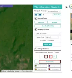
Users of Collect Earth Online (CEO) around the world are taking advantage of a CEO feature called the Geo-Dash Degradation Tool that allows them to monitor forest degradation, a major source of carbon emissions.
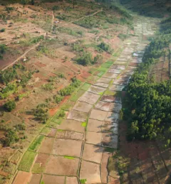
Rwanda is among the smallest countries in mainland Africa, roughly the size of Maryland with twice the population. Less land area means harder decisions, such as balancing land allocated for agriculture versus areas designated for forest conservation.
To sustainably manage forest landscapes, governments and decision makers need accurate and up-to-date information on the extent of the forests they manage and the ways they are changing.
This collection of case studies is a companion to the SERVIR Service Planning Toolkit. It provides concrete examples of SERVIR's Service Planning approach.
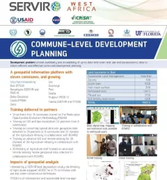
This fact sheet highlights how SERVIR West Africa is supporting sustainable management in Burkina Faso through commune-level development planning.
The Support for Commune-Level Development Planning in Burkina Faso service is developing an information platform for monitoring of the physical occupation, land use, land cover, and spatial data infrastructure of commune-level administrative areas in Burkina Faso to support decision making related to sustainable management.