Strategy & Guidance
USAID Geospatial Strategy

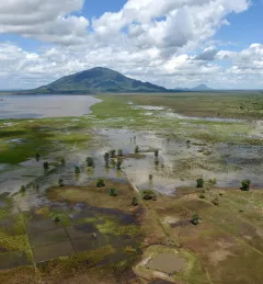
USAID’s 2024-2028 Geospatial Strategy promotes leveraging the power of geospatial data and technology to target the delivery of international programs.

159 results
USAID’s 2024-2028 Geospatial Strategy promotes leveraging the power of geospatial data and technology to target the delivery of international programs.
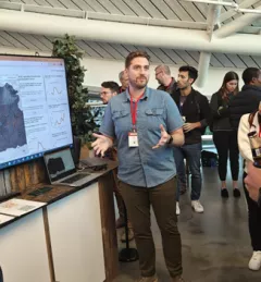
At Google’s Geo for Good (G4G) Summit 2023 in Mountain View, California, SERVIR scientists explained how and its collaborators are using artificial intelligence (AI) get more out of Earth data.
| Jake Ramthun, Biplov Bhandari, and Tim Mayer, NASA Science Coordination Office

SERVIR will be at the American Geophysical Union (AGU) fall conference December 11 - 15, 2023. We have compiled a list of SERVIR affiliated colleagues who will be presenting throughout the week. Please come and meet us at our talks and posters.

Governments in Southeast Asia can leverage the benefits of artificial intelligence (AI) through an enhanced tool, developed by SERVIR Southeast Asia (SERVIR SEA), to estimate the environmental and health impacts of air pollution in their countries and implement effective responses.
|Peyman Pejman and Peeranan Towashiraporn, SERVIR Southeast Asia

The end of one year and the start of the next provides an opportunity to reflect on past achievements and future goals. In 2023, the SERVIR network worked with local partners in the design and implementation of numerous geospatial services to address complex challenges related to climate change.
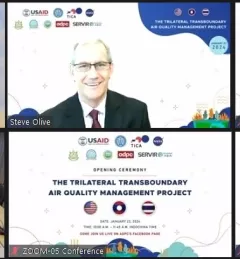
The USAID Regional Development Mission for Asia and Thailand International Cooperation Agency, along with other regional partner in Thailand in Lao PDR launched today a trilateral Transboundary Air Quality Management Project.
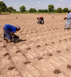
When irrigation isn't available, it's important to know when to expect rain. But with changes to our climate, farmers in West Africa can no longer count on a predictable weather. To mitigate this, SERVIR West Africa works with AGRHYMET to improve access to reliable weather and crop forecasts.
|Jacob Ramthun, SERVIR Science Coordination Office

Air quality is a significant challenge for Hindu Kush Himalaya (HKH), a high mountain region of South Asia, where it frequently reaches unhealthy to hazardous levels. New SERVIR HKH web and mobile tools developed through crowdsourcing aim to help public health and environmental managers monitor and forecast air quality for this region.
|Trista Brophy Cerquera (Former NASA Applied Sciences Intern), Elissa Fielding (NASA Earth Action Intern), Shobhana Gupta, MD, PhD (NASA Applied Sciences)
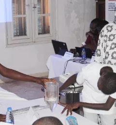
SERVIR West Africa created youth clubs to provide an inclusive space where all students, especially girls, can explore and gain skills in Science, Technology, Engineering, and Mathematics (STEM) and gain exposure to environmental monitoring tools such as geographic information systems, remote sensing, and other digital technologies.
|Thioro Codou Niang, SERVIR West Africa and Lena Pransky, Science Coordination Office
Disaster preparedness and the water resource management require reliable and timely information. In many regions of the world, ground observation data is scarce. Here are three ways that SERVIR's innovative services and tools enable decision-makers and authorities to address water challenges.
|Chinmay Deval, NASA SCO Water Security Lead