Strategy & Guidance
USAID Geospatial Strategy

USAID’s 2024-2028 Geospatial Strategy promotes leveraging the power of geospatial data and technology to target the delivery of international programs.

14 results
USAID’s 2024-2028 Geospatial Strategy promotes leveraging the power of geospatial data and technology to target the delivery of international programs.

SERVIR will be at the American Geophysical Union (AGU) fall conference December 11 - 15, 2023. We have compiled a list of SERVIR affiliated colleagues who will be presenting throughout the week. Please come and meet us at our talks and posters.

The end of one year and the start of the next provides an opportunity to reflect on past achievements and future goals. In 2023, the SERVIR network worked with local partners in the design and implementation of numerous geospatial services to address complex challenges related to climate change.
When irrigation isn't available, it's important to know when to expect rain. But with changes to our climate, farmers in West Africa can no longer count on a predictable weather. To mitigate this, SERVIR West Africa works with AGRHYMET to improve access to reliable weather and crop forecasts.
|Jacob Ramthun, SERVIR Science Coordination Office
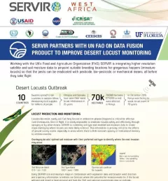
This fact sheet highlights how SERVIR is using satellite data to pinpoint breeding locations for locusts so that the pests can be eradicated before they take flight.

SERVIR improves local and regional capacity to provide tools, products, and services that empower decision makers to better address critical issues related to food security, water resources, natural disasters, land use, and extreme weather. Building on thirteen years of experience, SERVIR has grown in its geographical reach and has adapted its approach based on lessons learned.
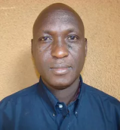
Dr. Issaka Lona, Food Security and Agriculture, Weather and Climate, and Water Resources and Hydroclimatic Disasters Thematic Lead for AGRHYMET / SERVIR-West Africa, is profiled.
A single desert locust can consume its body weight in vegetation in one day. When 40 million of them gather, they can devour as much food as 35,000 people.
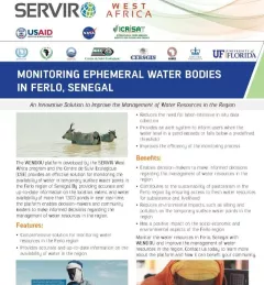
This fact sheet describes how SERVIR West Africa works with local stakeholders to strengthen the resilience of pastoral systems in Senegal.
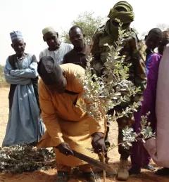
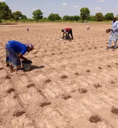
This service supports Farmer Managed Natural Regeneration (FMNR), is a low-cost land restoration technique used to combat poverty, hunger, and Sahara desert encroachments amongst low-income farmers by increasing ecosystem services; and resilience to climate extremes.