Tool SERVIR Service Planning Toolkit The Service Planning Toolkit is a resource for SERVIR Hubs and their partners to implement SERVIR's service planning approach. May 1, 2021
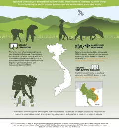
Fact Sheet Fact Sheet: Enhancing Drought Resilience in Vietnam SERVIR Mekong helped develop the Regional Hydrological Extremes and Assessment System (RHEAS), which automates the deployment of water resource nowcasting and forecasting applications to help mitigate the effects of drought in the lower Mekong region. January 13, 2021
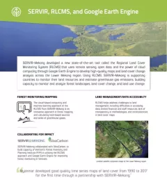
Fact Sheet Fact Sheet: Regional Land Cover Monitoring System SERVIR, RLCMS, and Google Earth Engine SERVIR-Mekong developed a new state-of-the-art tool called the Regional Land Cover Monitoring System (RLCMS) to develop high-quality maps and land cover change analysis across the Lower Mekong region. December 13, 2020
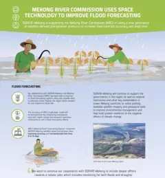
Fact Sheet Fact Sheet: Improving Flood Forecasting in the Mekong River Learn how SERVIR-Mekong is supporting the Mekong River Commission (MRC) in using satellite-derived precipitation products to increase flood forecast accuracy and lead time. December 13, 2020
Use Case Use Case: Nepal Forest Research Training Centre How the Nepal FRTC used the Regional Land Cover Monitoring System The FRTC, which is under the jurisdiction of Nepal’s Ministry of Forests and Environment, is the government-sanctioned organization that is responsible for forestry research and survey activities at the national level. September 28, 2020