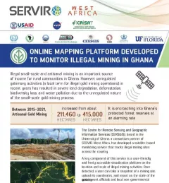
Fact Sheet Fact Sheet: Online Mapping to Fight Illegal Mining in Ghana This fact sheet highlights efforts to monitor illegal mining in Ghana. December 23, 2020
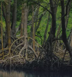
Training Mapping and Monitoring Mangroves using Google Earth Engine A Virtual Workshop hosted by SERVIR Amazonia This workshop is the third in a series offered by SERVIR Amazonia focused on using remote sensing to monitor mangroves in Guyana. December 15, 2020
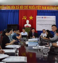
Use Case Use Case: Vietnam Academy for Water Resources VAWR, which operates under Vietnam’s Ministry of Agriculture and Rural Development (MARD), is the leading institute for water resources, research and development within Vietnam. September 22, 2020
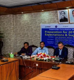
Use Case Use Case: Bangladesh Flood Forecasting and Warning Centre Enhancing Flood Early Warning Services aims to build the resilience of vulnerable communities in the Hindu Kush Himalayan region by increasing flood forecast lead times that are hosted on an interactive web platform. September 14, 2020
Use Case Use Case: Mekong River Commission The Mekong River Commission (MRC) is an intergovernmental organization that provides coordination and technical input on flood management to the members of the Lower Mekong countries including Cambodia, Lao PDR, Thailand, and Vietnam. August 31, 2020