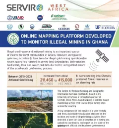
Fact Sheet Fact Sheet: Online Mapping to Fight Illegal Mining in Ghana This fact sheet highlights efforts to monitor illegal mining in Ghana. December 23, 2020
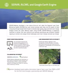
Fact Sheet Fact Sheet: Regional Land Cover Monitoring System SERVIR, RLCMS, and Google Earth Engine SERVIR-Mekong developed a new state-of-the-art tool called the Regional Land Cover Monitoring System (RLCMS) to develop high-quality maps and land cover change analysis across the Lower Mekong region. December 13, 2020
Use Case Use Case: Nepal Forest Research Training Centre How the Nepal FRTC used the Regional Land Cover Monitoring System The FRTC, which is under the jurisdiction of Nepal’s Ministry of Forests and Environment, is the government-sanctioned organization that is responsible for forestry research and survey activities at the national level. September 28, 2020
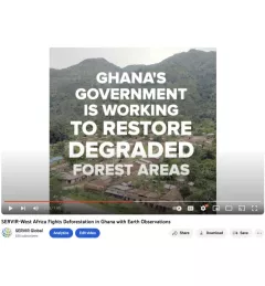
Video Video: Fighting Deforestation in Ghana with Earth Observations Ghana is home to some of the most biodiverse and carbon-dense forests in the world. But more than a third of them have been lost in recent decades. August 14, 2020
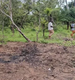
Use Case Use Case: A Rocha Ghana A Rocha Ghana (ARG) is an established environmental organization in Ghana that helps communities adapt to their changing natural environments. It currently works in the West Gonja District in northern Ghana where charcoal production is widespread. July 1, 2020