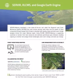
Fact Sheet Factsheet: Mekong Regional Land Cover Monitoring System (RLCMS) SERVIR, RLCMS, and Google Earth Engine December 13, 2020
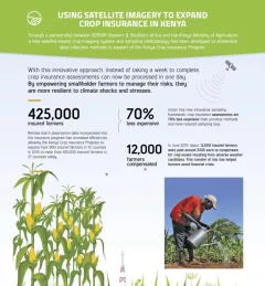
Infographic Using Satellite Imagery to Expand Crop Insurance in Kenya Through a partnership between SERVIR Eastern & Southern Africa and the Kenya Ministry of Agriculture, a new satellite-based crop mapping system and sampling methodology was developed to streaml October 23, 2020
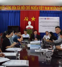
Use Case Use Case: Vietnam Academy for Water Resources VAWR, which operates under Vietnam’s Ministry of Agriculture and Rural Development (MARD), is the leading institute for water resources, research and development within Vietnam. September 22, 2020
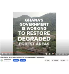
Video Video: Fighting Deforestation in Ghana with Earth Observations Ghana is home to some of the most biodiverse and carbon-dense forests in the world. But more than a third of them have been lost in recent decades. August 14, 2020
Video Video: Using Satellite Data to Monitor Locust Swarms in Eastern Africa SERVIR Global is using NASA satellites to guide USAID and FAO resources on the ground to fight locusts in east Africa. August 14, 2020