Fact Sheet
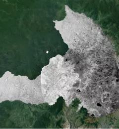
Factsheet: Mekong Regional Land Cover Monitoring System (RLCMS)
SERVIR, RLCMS, and Google Earth Engine

2 results
The Mapping with Radar in Imbabura service brings Synthetic Aperture Radar (SAR) and other remote sensing resources to map land cover of the province of Imbabura in Ecuador.